2015 was our year of visiting some of the most curious countries in the world. After two weeks in North Korea in September 2015 we decided for the year-end to visit Turkmenistan. Continue reading and get our best adventures and travel travel tips for the surreal Turmenistan.
The adventure started already before we arrived in Turkmenistan. First, we have learned that it is not allowed to explore the country by yourself by car in case you do not only want to have a transit visa for three to five days. Therefore, we were looking for a rental car with a driver. Second, the process applying for a visa. Luckily, Turkmenistan has an embassy in Frankfurt. Therefore, we called them to ask for the procedure to apply for a visa. This was one of the shortest telephone call ever since without any “Hello” etc. they told us that we shall look in the internet and hang up.
This is what we did and completed the respective forms and brought them to the mailbox of the embassy together with our passports. After only 10 days we had the passports back in our mailboxes with the respective visa included. Afterwards we have read and also heart from other travelers that we were lucky received a visa since there are only a few granted each year with a minority for tourists.
We have decided to take a flight via Istanbul instead of a direct flight from Frankfurt to Ashgabat. The main reason were the reports about the domestic airline. In Istanbul our flight was departing directly besides the gate where the flights to Kabul departed. Seeing people sitting at the gate in handcuffs was a strange feeling. Chaotic situation also at the Ashgabat airport where it was already hard to get to the luggage strap since it was very crowded with people and suitcases as well as parcels.
Our route through the country
We have determined our route together with Ayan Travel. They have also booked all hotels for us and organized our English speaking driver Dmitri. He has picked us up at the airport and drove us the main attraction during our seven days in Turkmenistan. In the cities we were allowed to walk around on our ones. In general our driver has even not stayed in the same hotel as we did.
Before getting back from our trips through Turkmenistan to Ashgabat we always had to stop at a car wash since it is not allowed to have a dirty car in Ashgabat.
Ultimate travel tips in Turkmenistan
Ashgabat
We arrived at the airport in Ashgabat very early in the morning. After a short rest in the hotel lobby since the hotel was not really open, we started our exploration of Ashgabat. Ashgabat is listed in the Guinness Book of World Records due to the highest concentration of white marble buildings in the world. The reason is that the president loves the white color.
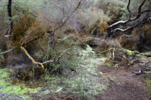
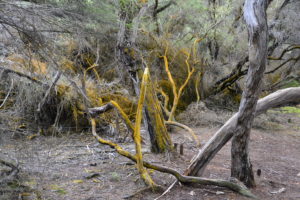
This is also reflected in the color of the cars. We have never seen so many cleaning crews who clean the sculptures, fountains and the ground (!) of the parks throughout the day. The following picture shows an underground passageway to cross the streets – incredible clean.
Government buildings
Since our hotel Grand Turkmen is located in the city center close to the government area, we explored the area by walking. Unfortunately, we cannot show you many pictures of these impressive government buildings since it is forbidden to take photos of them. In addition, we were asked twice by police men to delete all pictures on our camera. They didn’t let us go without checking our camera by their own. Even stopping and starring at the buildings is forbidden. If you do it anyway, you are very clearly told to move on.
Turkmen architecture
Ashgabat as the white city has a curious architecture. Since we were driving through Ashgabat on 1st of January, the streets were quite empty. Throughout the city statues and pictures from the president are present everywhere.
Arch of Neutrality
The Arch of Neutrality is the highest building in Ashgabat. With its 95 meters and was relocated in 2011 from the independence place to a site at the South of the city. The monument stands on three feet; on its top is a golden statue of the former Turkmen president. Form the top viewing platform we enjoyed a great view over the area.
Independence Monument Ashgabat
The design of the Independence Monument was inspired by traditional Turkmen tents (yurts). Based on the year of independence 1991 the tower is 91 meter high with a golden steel construction on top. The building is surrounded by green landscaping. It encompass 27 heroic statues of Turkmen leaders and a fountain with a statue of Turkmenbashi. The park includes a gigantic replica of the main book Ruhnama. It stands there in bright pink and green that could have been opened.
Wedding Palace
The first five floors of the Wedding Palace are in the shape of a rotating Turkmen star. The remaining five floors are in the shape of a sphere resting on this Turkmen star and surrounded by it are five other Turkmen stars. On both surfaces of the glass sphere are remarkable titanium maps of Turkmenistan.
In addition to the halls for weddings and marriage ceremonies, the building also includes several other units such as a hotel, a shopping center, grooms’ rooms, waiting rooms, cafeterias and foyer rooms.
Turkmenbashi Mosque (outside of Ashgabat)
Turkmenbashi Mosque is approx. 20 minutes outside of the city and is the largest mosque in Turkmenistan. The magnificent building made of the finest marble and granite with an imposing gilded dome was built at the site where Turkmenbashi’s mother and two brothers died in a severe earthquake. The four minarets with the height of 91 meters represent the year of independence of 1991 and are decorated with sayings from Ruhnama (Turkmenibashi’s main book).
Anau Mosque
12 km outside from Ashgabat in the direction to Mary lies the Anau mosque. This mosque was built around 1455 on the ruins of a fortress. The former powerful outlines of the mosque were visible from a great distance. Still today you can see the colorful mosaic decorations. The mosque was destroyed by the 1948 earthquake. Nevertheless, the mausoleum of a sheikh located nearby the mosque serves as a pilgrimage site.
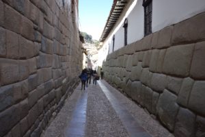
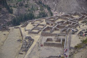
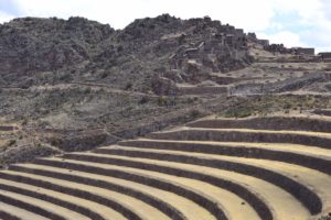
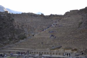
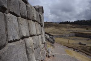
Nisa fortress (UNESCO World Heritage)
Parthian Fortresses of Nisa was founded in the third century BC and was the most important city of the Arshakid Dynasty. Many temples and palaces, treasuries, reservoirs, warehouses and houses were built in Old Nisa. The powerful fortress walls, nine meters thick, were fortified with forty-three tall towers.
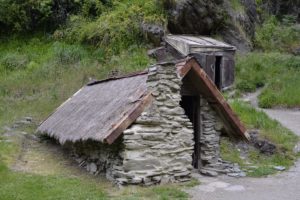
Erbent Desert Village
On our way to Darvaza we stopped en-route at a traditional desert village (Erbent Desert Village) to see the everyday life if Turkmens living in the desert. The people are living the traditional way in a clay house with a yurt next to it. The village is famous for felt products in particularly high quality. Honestly, we felt unwell walking through this small village since we do not believe that they are used to tourists and we didn’t want to bother them in their daily life.
Darvaza (gateway to hell)
The reason for this crater is not sure but the most probable cause is that during drilling for natural gas the stone collapsed. There were fears that toxic gas would leak out, endangering nearby settlements. To avoid this, it was decided to set it on fire. Against the assumption that it will turn off after a couple of days, it is burning for decades already. Another possibility is that the crater was formed naturally, possibly by a lightning strike.
The crater with its diameter of 70 meters is not easy to find since no signs are available. But our driver Dmitri was used to drive tourists to this hot spot so it was no problem for him to find the way.
We spent the night nearby the crater in a traditional yurt so that we had the possibility to walk in the night to the crater. This was also the reason why we stopped on our way to the crater to collect some wood. Dmitri prepared on the fire a dinner with traditional salads for us inside of the yurt. Since it was end of December it was pretty cold so that the fire inside the yurt had to burn the whole night.
Kunya Urgench (UNESCO World Heritage)
After that quite short, freezing night in the yurt we spent the next morning with Dmitri in the car. Our target for the day was Kunya-Urgench located in the north-western part of Turkmenistan. The ride of around 300 km went quick by as the roads were pretty good and without much traffic. Kunya-Urgench as part of the Turkmenistan UNESCO world heritage sites was an ancient regional capital as part of the Achaemenid Empire and saw its golden times between the 11th and 16th century.
The site contains a series of well-preserved monuments like the 60-m high minaret, a mosque, mausoleums and remainings of a caravansary. Especially Paul who is a big fan of Islamic architecture went absolutely crazy. He was jumping from one monument to the next, taking tones of pictures and it was difficult to get him back to the car.
Dashoguz
Continuing our journey to the city of Dashoguz we could see the boarder fence to Uzbekistan. At that point we had no idea that two years later we will be exploring Central Asia exactly on the other side of the fence during our world trip. Since we did not had time to visit this city we can only show you pictures from our hotel and the breakfast room where we also tried to get a dinner.
Izmukshir and Shassenem fortress
On our way back to Ashgabat we stopped at Izmukshir and Shassenem fortresses what is part of the tentative UNESCO World Heritage for the silk road in Turkmenistan. The fortresses just lies 25 km to the south-west of Dashoguz in the desert.
Only ruins of ancient the fortress city are visible that are mainly covered with sands. The fortress ruins are located in the territory of the historical and cultural reserve Kunya-Urgench. The ruins show how huge the fortresses must have been in the past.
Mary
Abiverd medieval fortress
Before arriving in Mary we stopped at Abiverd medieval fortress. Abiverd was once an important trading town and a key link on the Silk Road between Nisa and Merv. Abiverd in its heyday had a sophisticated system of water supply, produced highly regarded pottery and minted its own coins. The present-day site offers only a hint of these past glories but the many splits on the ground give an impression of the richness of the town.
Impressions from the drive to Mary
The pictures in the middle shows a truck with the main export product of this area – cotton – and world’s largest yurt.
Mary
Mary formerly known as Merv is the central city for cotton and natural gas production. The ruins of the ancient city Merv are located nearby. The ancient city of Merv was an oasis city on the Silk Road. It was destroyed in the 12th century by the Mongols and again in the 19th century. In Mary we have visited the Gurbanguly Hajji Mosque and made a walk through the city. Of course, we also discovered some examples of the cult of personality of Turkmenibashi.
Merv (UNESCO World Heritage)
In the morning we continued our journey to Merv which is another UNESCO World Heritage site with the official name State Historical and Cultural Park “Ancient Merv”. The site is one of the oldest and best preserved cities in the oasis along the historical Silk Road in Central Asia. During the 12th century, Merv became one of the largest cities in the world with a population of around 500,000. After the invasions by Mongol hordes in the 13th century, the city started loosing its importance and by the 1800s was completely deserted.
During our half-day trip, we had a chance to visit one of the oldest parts of the complex which is the citadel fort called Erk Gala, built in the 7th century BC.
We also visited the Sultan Sanjar mausoleum which is one of the best preserved structures and built around the 12th century. However, most impressive are the so called Great ant Little Kyz Qala with its huge mud brick walls of more than 10m. The former probably served as the semi-fortified home of an important official, perhaps even the governor of Merv. Walking along these ancient buildings gave us the feeling traveling back in history.
Our recommendations for Turkmenistan
Travel guide
For our Turkmenistan travel tips we relied again to our favorite travel guide Stefan Loose. It includes for Turkmenistan the main sites that are possible to visit.
Packing list for travelling – how to travel light and efficient
During our travels we have recognized that travelling with a light backpack is one of the key drivers that makes trips more efficient. Therefore, we want to share our packing list for travelling with you.
Having a light backpack is also important when you are renting a car as we prefer to do it on our trips. We experienced that taking every evening the backpacks from the car into the guesthouse is annoying, especially when we hardly managed passing through the door and even harder to take the stairs up to the room. Therefore, we removed with each travel more and more items from our backpacks.
The essential items are listed here as an indication and guideline for you because we are sure that there is NO master packing list due to individual wishes especially in regards to clothes and technical equipment. Especially the technical equipment is still one of our personnel (and honestly big) discussion points when preparing the backpacks 🙂 We have added here also affiliate links for the products we are really using ourselves and are convinced of the added value and the quality.
Find a best-fit backpack!
The most important element of a comfortable travel is a well fitted backpack. We spent several hours in an outdoor shop to find the one backpack fitting the best to our backs. Do not forget to walk around in the shop with weights included. I am now using for five years the backpack from GREGORY Deva (60 liter) and Paul is carrying also a GREGORY Baltoro with 75 liter.
We are in general using two day backpacks whereas one is from Jack Wolfskin with separated sections to organize the items. In addition, we have a small bag for the camera. Previously, we have used the Salewa bag pack what was very convenient for our trips but this one did not had any special shelf for a notebook.
Packing & Wrapping
We are organizing and sorting all the items with laundry nets and basic bags. We are packing a whole cloth set for one or two days so that we do not need to take out all the items from the backpack and re-pack it every day completely:
Documents
The following documents are very useful for a trip (in some cases copies are sufficient):
Passport and local ID cards (original documents but also copies in case you do not want to show or hand-over your official passport or also in case of a theft)
Vaccination certificates (we always take only copies of our vaccination certificates)
Global health insurance (original letter / certificate and copy)
Local driver license
International driver license for travelling outside of Europe (please pay attention that the international driver license originated in Germany expires three years after origination and needs to be renewed)
Airplane / train tickets or pre-booked hotel confirmations (electronic versions are sufficient) but it is worth to have the address and telephone number of the first hotel at hand on a piece of paper so that the bus / taxi driver can contact the hotel to confirm the address / way
Telephone numbers to lock the credit cards in case of the fraudster
We have digital copies of all these documents in a secured area of Dropbox and Google drive.
Clothes
Clothes are a very individual topic. We try to minimize the clothes since laundry shops are all around the world available and are in general cheap. Depending on the climate zone we take clothes for maximal five days. Especially, functional trekking ware is perfect since they are drying very fast and you can also wash them overnight in the bathroom if needed.
Since I cannot live without going for a run, I am in general wearing my running shoes on our trips when not walking around with flipflops. Paul has special trekking shoes but they should be light and breathable to wear them in warmer as well as in colder areas.
There are three pieces of clothes we are always taking with us since they are so multifunctional and good for warm as well as cold weather:
Long-sleeve Merino shirt
Merino legging
Fleece jacket / pullover
Daily utensils & other items
Other useful items we have always with us are the following things (links to our products see below)
Light weight sleeping bag
Insect Shield Inlet von Cocoon (one in line and one in silk)
Mini Swiss set incl. needle, knife, scissor, tweezer, small screwdriver – this was a present from my former company and this is unbelievable helpful and so light (but please put it in your check-in luggage)
Money belt to carry larger amount of cash
In colder areas we take our sleeping back with us (especially when going camping)
Sunglasses
Thermos bottle (0.5 liter) and some small packages instant coffee (since we were not always happy with the local coffee)
Non-slip bathing shoes
Old credit cards as fakes for the wallet (in case of a robbery)
Pillow and neck pillow in one (non-inflatable) – yes, indeed, this pillow needs some space in our hand luggage but it is worth due to the comfort and I am using it also in the hotels on our trips
Travel clothes line
For colder areas we also take a sleeping bag with us. But since the backpack are already quite staffed with long clothes for us, the weight and the size of the sleeping bag were our important criteria. This is why we have chosen the following one since with its 1.3 kg it is quite light. The recommended temperature is about -9 degree Celsius what was sufficient for our purpose since we are using the sleeping bag in majority in not (sufficiently) heated guestrooms or the campervan.
Washbag
Our washbags are in general quite heavy but we have recognized that cosmetics are in other countries quite expensive. We have in general the following items in our washbag:
Toothbrush
Tooth paste
Day and night face cremes and light makeup
Deodorant stick
Shampoo
Comb
Makeup pads / humid face tissues
Shaver and shaving cream
Sun blocker
Hand disinfection tissues and gel
Sewing kits
Since we are wearing glasses, we always put some packs of contact lenses in our bag
We are not taking any soaps since in general soaps are available in the guesthouses.
Medicine
In general, the main medicine will be available in each country however it is always good to take some basic medicines for immediate intake:
We have just bought last year a new Garmin for navigation since we are using it the whole time during our trips (when walking around and also for car navigation). We currently using Garmin eTrex Touch 25. This is now for us the first time with a touch display of the Garmin. But after the first three trips, we are very satisfied and it is easier to navigate compared to the small button we had with the Garmin eTrex 20. The handling of the Garmin are comparable between the different versions and the touch screens makes the zooming more comfortable.
Welcome to our travel guide for globetrotters & UNESCO enthusiasts and discover top Myanmar (Burma) travel tips – the country of gilded pagodas, spirituality and hospitality.
If you want to read more about the country, we can recommend you some books.
First and ever remaining impressions of Myanmar (Burma)
On the 16th February 2017, we arrived in Myanmar – our second to the last country on our round-the-world trip. The first thing we have recognized arriving in Myanmar is the extremely friendly people. Consequently, walking through the streets people offered their help to find what we are looking for. Unbelievable for us: without trying to sell us something or to lead us to their shops or restaurants. We need to get used to not directly rejecting their offers what we have ourselves adopted in the other Southeast Asian countries. In total, we could not imagine a better ending for these two months of being in Southeast Asia. We hope, the Burmese do not get upset of tourists and keep their openness and friendliness. Even monks are looking with an amazing open-mind for contacts with foreigners and took pictures of us or with us.
Together with its cultural highlights like astonishing Bagan and the pagodas in Bago and Yangon, Myanmar is really a unique country.
Our route through Myanmar
We arrived in Mandalay by plane from Bangkok. Unfortunately, self driving is not possible for tourists in Myanmar. Therefore, we have taken for the longer distances buses and trains. The buses and trains were in general all comfortable and very cheap. For example, we have taken a train from Yangon to Bago and paid around 30 cent for a a lower class ticket for the two hours drive which was written by hand. In addition, in the cities and towns we have always rented electric scooter and e-bikes to get around.
Conditions of the roads
However, we have read about the bad condition of the roads due to the small investments in the infrastructure after the colonial era. But we have not expected such bad roads. The journey lasted six hours for approx. 300 km from Mandalay to Yangon with “free massage” as we have been well shaken during the drive. This journey is currently the most shaky we had on our trip. Therefore, we are lucky that we could share this experience with Paul’s cousin Michael and his wife Katrin with whom we are traveling together in Myanmar for one week.
Countryside in Myanmar
The journey lead us through barren landscape and a lot of beggars along the route. This is the other side of the coin for the low tourism. Since 1962, the military is governing Myanmar with focus on the wealthiness of certain group of people. The population has to pay for this mismanagement and inability with poverty. Above all, the name Myanmar was introduced arbitrarily in 1989 by the government without involvement of the people.
Driving in Myanmar – on the left or right side?
Since Myanmar is a former British colony, we have expected a left-hand traffic. However, they are driving on the right hand side but the majority of the cars have their steering wheel on the right side. This is caused by a vision of the former dictator in the 1960’s. From one day to the next he changed from left to right-hand traffic in order to relieve from a British colonial relic. The actual reason was a fortune teller who said that the left side is bad. Due to the fact that many cars are imported from Thailand where the cars drive on the left side, the steering wheels are still on the right side.
This is only one story about the dictator’s superstition. Another one is that he introduced 45 and 90 Kyat bills and voided all others since the number nine was his lucky number. Consequently, this resulted in math exercises during shopping.
Our ultimate Myanmar (Burma) Travel Tips
Mandalay
Mandalay as the second largest city in Myanmar is Myanmar’s religious center with its many monasteries and monks. Moreover, Mandalay was the former royal capital before the British defeated the Upper Burma. The city was named after the Mandalay Hill that you should climb up to get breathtaking view of sunset or sunrise.
Myanmar is the first country where we are taking less pictures from the locals compared to the pictures the locals are taking of us or even ask us for pictures and selfies. We met a group of monks in one of the pagoda in Mandalay and every one wanted a pictures with us together.
Gold Leaf Manufacturer
One gold leaf manufacturer next to another can be found in the 36th street. Small gold nuggets are transferred into extremely thin gold leaves through rhythmic hammering by well-trained men. Despite this hard work, it is a popular job because the gold leaves are used for higher purpose: it is used to stick on Buddha statues to earn points for the reincarnation. Some Buddhas are covered with so many gold leaves only that their shape is already gone.
Kuthodaw pagoda
The Kuthodaw pagoda consists of 729 small stupas containing each a marble board with stories about Buddha’s life and doctrines. This pagoda is also called the biggest book in the world and the construction lasted more than seven years. If someone would read every day for eight hours, he would need probably 450 days to read the whole book.
Royal Palace
The golden Royal Palace in Mandalay was built 1857 and contains more than 130 buildings. Since the king feared leaving his palace, a 55 meters high tower was built as the single possibility to watch the outside life. However, most parts of the palace were destroyed by the colonial power as well as during the war against the Japanese occupying forces. For the restoration, corrugated iron roofs and golden color instead of gold leaves were used.
The UNESCO World Heritage Site of Bagan
Bagan is one of the architecturalhighlight in Southeast Asia. But compared to Angkor, Bagan has still something magical and mysterious. There a no huge crowds of tourists and exploring the area is mainly possible by horse carts or electric bikes. Big buses are rare. And so it happened that we were completely alone visiting some temples. Pictures from Bagan temples and balloons are the most popular picture of Myanmar and one will have it in mind when thinking of Myanmar. Around 2,200 temples, pagodas and stupas are located in Bagan. Bagan was listed recently as UNESCO World heritage. The reason for this long waiting list was that Myanmar did not adhere to the specifications for historical landmarks and the restoration was done with cheap construction material not matching to the original one. In 2019, the UNESCO finally added Bagan to the list of cultural heritage sites.
Recommended horse cart tour
We started our exploration tour of Bagan with a traditional horse cart ride. For one full day we went from the most popular temples with a horse cart. Unbelievable, entering the temples and pagodas is only possible without shoes and socks. Walking around barefoot in these around 800 years old temples and pagodas was a challenge due to the sun heated stones as well as the many small stones and sand on the ground.
Sunset and sunrise in Bagan
For the sunset on the first day we have chosen a stupa where we could climb up to the third level with an amazing view over its temples and stupas scattered area. However, this spot is quite popular and so we were already climbing up the temple around 4.30 pm to get a good place for the sunset around 6 pm.
For the sunrise the next morning we have identified another temple off the beaten path with less tourists (maybe also due to the early sunrise at 5.45 am). It was astonishing when the balloons started and were flying over the temples. This view has more than paid off the early getting up.
Remote temples at Bagan
For the second and third day in Bagan we rented e-bikes to explore the more remote temples. E-bikes are (rather electronic scooter) a good idea in this dry and hot area of Myanmar. The temples with only one level at the ground floor are older compared to them with several levels. The main material was brickstonesbrought to Bagan by boat. All still existing buildings had religious purposes, the palaces and the houses of the kings have not survived the long time and especially the fights against the Mongols. Even after the period where Bagan was a royal city, Burmese kings donated bells and gold for the stupas and even two new temples were built in the 18th century. Uncountable are the Buddha statues in the temples in many different sizes and colors.
Mount Popa
We hired a private taxi to get from Bagan to Mount Popa for a half day. The reason for the private taxi was mainly due to time constraints and we wanted to enjoy another half day at least in Bagan. 787 steps lead to the top of the mountain but also here we had to walk barefoot. Another challenge were the many monkeys running and jumping around and their poopson the stairs. But the view from the top and the small temples were worth climbing up.
Pyay – non touristic place
A huge adventure was our trip to Pyay. From Yangon Pyay can be reached via bus (approx. seven hours drive). Sri Ksetra located just a few kilometres from Pyay is an ancient capital. Not many buildings have survived since the 9th century when the center was relocated towards Bagan. The Baw Baw Gyi Pagoda remained with its 43 meters tall stupa. The last king has taken some relics away and brought them to one of the pagodas in Bagan. To avoid further theft the ‘Grand Lady’ is watching the pagoda sitting on a swing. Devouts donate scarfs to the Grand Lady.
Pyu (Pyay) Ancient Cities – UNESCO World Heritage Site
To get to the area of the ancient capital in Pyay we have rented a motorcycle directly at the hotel since we arrived quite late with the bus from Yangon. Besides issues starting the motorcycle, changing the gears felt like riding a horse. Paved roads are not really existing in Pyay and so we had to cross sandy roads – sometimes with so many sands that we had trouble to not fall down – with wild dogs everywhere around. Due to the late afternoon we only stopped for some minutes at each pagoda to avoid driving during darkness through this countryside. We have the impression that not many tourists visit this site since we haven’t met anybody else and the choice of hotels is very limited. And why did we do all of this? For extend our lovely bucket list of UNESCO sites.
Bago
Bago is just 80 km from Yangon and so we decided to take a train to get there. Our train didn’t had windows and also the door was not closing during the journey but due to the low speed of the train it was perfect. The train station looks like an original heritage from the colonial era.
Taking the train from Yangon to Bago revealed a side of Myanmar that we haven’t seen before: the extreme poverty of the Burmese people and the non-existence of a waste management system.
No other city in Myanmar has such a density of religious sites like it is the case in Bago. We rented e-bikes to visit the pagodas in this non-touristic city. It seems that e-bikes are not common in Bago since the locals were surprisingly looking at us. To confuse them even more, when passing slow motorcycles we started pedaling as much as possible despite the electric engine.
Four Buddhas in Bago
In the South of Bago four sitting Buddhas are located. Of course there are many Buddha statues in Myanmar and one is bigger, more beautiful or more golden like the other but these Kyaikpun Buddhas are special. They are sitting back to back and looking into the four cardinal points. The one looking to the North is the current Buddha Gautama and the other three are his predecessors. The statues are originally from the 15th century but have been restored in the last years with brilliant fingernails, white skin and deep red lips.
Shwethalyaung Pagode
The reclining Buddha inside the Shwethalyaung Pagode is with its length of more than 50 meters one of the largest Buddhas in the world. This position symbolizes Buddha shortly before his death. This Buddha was standing outside but to protect him, a roof construction (inconvenient for pictures) was built.
Directly next to the Shwethalyaung Pagoda lies another huge Buddha statue – but this time, in the open air. This Buddha was built around ten years ago. Since there are no big trees around to provide shade, our feet were grilled walking around barefoot on these green tiles.
Shwemawdaw Pagoda
The Shwemawdaw Pagoda has the highest stupa of Myanmar and was restored several times due to earthquakes. And every time the pagoda was getting bigger and more beautiful. The once fallen down top of the pagoda has now been integrated into the structure in a way to remind of this occurrence.
Kinpun
The Golden Rock in Kinpun is one of the most important Buddhist sanctuary in Myanmar. The rock is only held tight by Buddha’s one hair that is positioned inside the golden stupa on top of the rock. To get up on the mountain you can either walk three hours or take a truck for 40 minutes. A truck starts when the benches on the loading area are more than full (approximately 40 people). Going up the around 700 meters is fine due to the ascent but for going down we have kept the fingers crossed that the breaks will make it.
Yangon
We spent our last two days in Myanmar in Yangon. Yangon was Myanmar’s capital until 2006 when the army declared surprisingly the newly founded city Nay Pyi Taw as the new capital. However, the new capital is located in a region that is still closed for foreigners.
Shwedagon pagode
The Shwedagon pagode in Yangon is one highlight of our trip so that we spent a lot of time there to see the sunrise and the sunset. It is said that the pagoda is around 2,500 years old. The stupa is around 100 meters high and with the gold leaves on it, the stupa weights around 150 tons whereof around ten tons are pure gold. Every third year, the gold is taken away and the stupa gets completely new gold. The umbrella on top has several thousands of diamonds and little bells.
Sule Pagode
What you should not miss in Yangon is the visit of the downtown area. We have taken a bus from the Shwedagon Pagoda to the city center. In the middle of a roundabout, there is another beautiful golden pagoda (Sule Pagoda).
Colonial houses
Yangon’s second face consists of respectable colonial houses. The majority of the houses were built at the beginning of the 20th century. Despite the tendency to modernize Yangon, the locals renovate the ancient houses on a regular basis. Still in use is the baby blue City House with Yangon’s government and the post office. In the latter we have learned that the post office for parcels is only open 2.5 hours per day – despite many employees have been around four hours after the official closure.
Myanmar from another time
The man on the picture looks like from another time. We found him sitting in front of a house with this old typewriter. What an impressive end of the really stunning visit of Myanmar. Highly recommended to visit Myanmar to all of you.
Thanaka paste
You might have seen a bright crème in the Burmese’s face and may ask yourself: what is this that they put on their face? This is Thanaka paste – the most widely used skin lotion in Myanmar. The Thanaka tree grows mostly in the sandy regions of Central Myanmar and needs about 30 years to be harvested. The locals use Thanaka as a protection against the sun. Moreover, the paste lightens the skin and many say that it is the secret for their anti-aging.
Our book recommendations
Travel Guides
As a English guidebook we have made good experience with the Lonely Planet Myanmar (Burma) guide. It has a good overview of country highlights, some maps and useful accommodation tips.
Novels
The following novels have we either read by our own or they have been recommended to us.
Burmese Days – George Orwell: Orwell draws on his years of experience in India to tell this story of the waning days of British imperialism. A handful of Englishmen living in a settlement in Burma congregate in the European Club, drink whiskey, and argue over an impending order to admit a token Asian.
The Art of Hearing Herat Beats – Jan-Philipp Sendker: When a successful New York lawyer suddenly disappears without a trace, neither his wife nor his daughter Julia has any idea where he might be…until they find a love letter he wrote many years ago, to a Burmese woman they have never heard of. Intent on solving the mystery and coming to terms with her father’s past, Julia decides to travel to the village where the woman lived. There she uncovers a tale of unimaginable hardship, resilience, and passion. It will reaffirm the reader’s belief in the power of love to move mountains.
The Long Path to Wisdom – Jan-Philipp Sendker: These moving stories speak to the rich mythology of the diverse peoples of Burma, the spirituality of humankind, and the profound social impact of Buddhist thought. Some are so strange he couldn’t classify them or identify a familiar moral, while others reminded him of the fairy tales of his childhood. Except that here monkeys, tigers, elephants, and crocodiles inhabited the fantastic lands instead of hedgehogs, donkeys, or geese. Their morals resemble those of the Brothers Grimm or Hans Christian Andersen, illustrating how all cultures draw on a universal wisdom to create their myths.
Saving Fish from Drowning – Amy Tan: San Francisco art patron Bibi Chen has planned a journey of the senses along the famed Burma Road for eleven lucky friends. But after her mysterious death, Bibi watches aghast from her ghostly perch as the travelers veer off her itinerary and embark on a trail paved with cultural gaffes and tribal curses, Buddhist illusions and romantic desires. On Christmas morning, the tourists cruise across a misty lake and disappear.
Further reading
Myanmar (Burma): Temples of Bagan – David Raezer: We have read this book by ourselves during the visit of Bagan. Bagan, the ancient Buddhist capital in central Myanmar (Burma) that thrived from 850-1300, is one of the most magnificent and inspiring sites in Southeast Asia. It is yours to uncover.
The River of Lost Footsteps – Thant Myint-U: How is interested in Burma’s history and political system, should not miss this book. hant Myint-U tells the story of modern Burma, and the story of his own family, in an interwoven narrative that is by turns lyrical, dramatic, and deeply affecting. Through his prominent family’s stories and those of others, he portrays Burma’s rise and decline in the modern world. From the time of Portuguese pirates and renegade Mughal princes through a sixty-year civil war that continues today―the longest-running war anywhere in the world.
Freedom from fear- Aung San Suu Kyi: Aung San Suu Kyi is the most popular person of Burma. How wants to read more about her life as opposition politician and Nobel Peace Prize Laureate should read this biography of the Swedish journalist Jesper Bengtsson.
Georgia was for a long time on our bucket list for visiting after exploring Armenia which shares together with Turkey, Azerbaijan and Russia its boarders. However, it took us six years after our trip in Armenia to get to Georgia. Welcome to our travel guide for globetrotters & UNESCO enthusiasts – discover the top travel tips for Georgia – we promise to you that you will love Georgia’s impressive monasteries, landscapes and the super delicious food.
Flights from Germany to Tbilisi are available directly from Munich. But can also be reached with stop-over flights via Vienna, Istanbul, Warsaw. The direct flight from Munich lasts about four hours. I need to admit that during our travel through Georgia I was quite busy working with very kind but ambitious clients. Consequently, I also had to take my laptop with me to continue working (what by the way I did during the time Paul was driving – so the roads are really convenient). As always when you do not need further trouble, the following has happened: On our arrival in Tbilisi in the early morning hours our both luggage were left behind in Munich. However, Lufthansa was very eager to get our luggage to Tbilisi what indeed happened only one day later. In the meanwhile we shopped the most necessary utilities like underwear and cosmetics.
Our travel route through Georgia
We stayed in Georgia for ten full days whereof 2.5 days in Tbilisi. Our visit took place from mid until end of July 2018. This time was really perfect due to the wonderful whether we had all the days and could also sit outside in the nights. Georgia is getting more and more popular as a touristic destination so that it can get very crowded during the summer time.
Our experience of self-driving in Georgia
Exploring Georgia and especially the sometimes far away UNESCO World Heritage sites by self-driving is a really good way. The international rental companies are also available in Georgia, e.g. like Avis. Avis is located next to the Marriott Hotel at a central square. The roads in Georgia are in good conditions. We have chosen a standard rental car without four wheel drive what was sufficient for the tour we made except for Ushguli. To get from Mestia to Ushguli you need a 4WD car. The rental company called our attention that the car is equipped with GPS to track our route. They wanted to ensure that we are not damaging the car intentionally and are not going to the restricted areas.
Our ultimate travel tips for Georgia
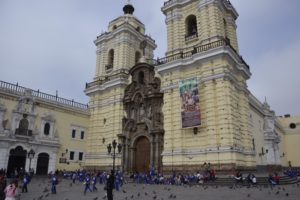
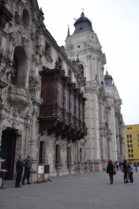
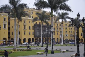
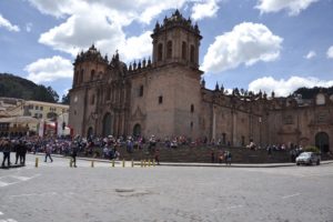
Tbilisi
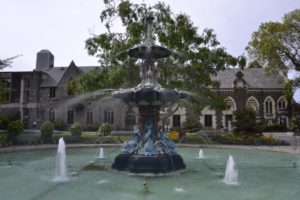
There are many ways to get around in Tbilisi: buses, taxis, local Uber but also by foot. We have chosen the last option. But be careful: it is really easy to get lost in the beautiful old town with its narrow but picturesque streets. Well the list of things to do in Tbilisi is incredible long.
How many days should you stay in Tbilisi?
From our point of view the absolute minimum is two days for Tbilisi. But due to the many sights the more days you can spent in Tbilisi the better. We also have heard of a really good nightlife in the capital.
1. Abanotubani (Sulphur Bath / Thermal Bath) and Leghvtakhevi waterfall
The style of the Old Town is a mix of Asian and Arabic influences interwoven with European and traditional Russian architecture. Some parts are comprehensively renovated so that it looks a bit kitschy though far more of the area is untouched. Wandering through the alleyways and the ancient churches feels almost like a walk back in time. Although we didn’t go for any treatments, we wandered around the area with the mixture of different cultures and its specific treatment types like hot baths. The name Leghvtakhevi comes from the Georgian word “Leghvi” which means fig. There were so many trees of fig around this place.
2. Take the cable car (or walk up) to Narikala Fortress
In case you would like to walk up, take the small path next to the Armenian church St. George. You will have an incredible view on Tbilisi from the hill of Narikala Fortress. The original fortress dates back to the end of 4th century but has been destroyed several times during the history. With each reconstruction the fortress has been enhanced by different people. Nevertheless, only ruins remain after a lightning strike into the powder magazine of the fortress in 1827. The fortress was not rebuilt after that event.
The visit of the ruins is free of charge and really worth wandering around. Just a short walk away along the many souvenir stalls you reach the Georgia’s Mother. It is a 20 m high statue made of aluminum. In her right hand she holds a sword for the enemies and in her left hand coming from the heart wine for the friends.
3. Puppet Theatre Rezo Gabriadze
The clock tower is the new symbol of the state-owned puppet theater. The clock tower was built in 2010 and looks like messed up stacked boxes. Each hour a small angel puppet comes out of the door and rings the bell. You can enjoy a greater show. At the time we visited Tbilisi it was shown at 12 pm and at 7 pm.
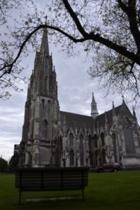
4. Zminda Sameba Cathedral
We have spotted this cathedral from the Narikala Fortress since it is illuminated in the night and also situated on a hill (Elias hill). Zminda Sameba Cathedral is the largest church in the region of Transcaucasia (i.e. Georgia, Armenia and Azerbaijan). It was finished in 2004 after nine years of construction. The bells of the Cathedral were created in Germany. You can reach the cathedral by a walk from the city center.
5. Bridge of Peace
This bridge catches your eyes immediately. For the Georgians, the bridge was controversial due to the high building costs in 2009/2010. Nowadays the bridge is a popular photo-stop.
6. Liberty Square (Tawisubleibis Moedani)
Formerly know as Lenin square the statue has been exchanged in 2006 with the gilded dragon slayer George. We used the liberty square as a central point for our orientation since also our car rental company is located at the square. On the other corner the city hall dominates the square.
7. Kwaschweti Church
On the opposite site of the School no. 1 in the Rustaveli Street we found this beautiful church. The church consists of two levels and includes a small museum. We also enjoyed sitting in the park that surrounds the church since it is a bit away from the busy Rustaveli Street.
8. Monument to the Lamplighter in Barataschwili Street
You might need a lot of patience when you also want to climb the ladder of the lamplighter since everybody is doing it. Not sure why everybody is touching his butt. But no worries there a lot of different bronze statues all over the city.
9. Rike Concert Hall in front of the Presidential Palace
The futuristic concert hall is together with the Bridge of Peace is located next to the Mtkvari River. The concert hall reminds of a lindworm due to the tubes that is monitored by the Presidential Palace.
10. Sioni Church
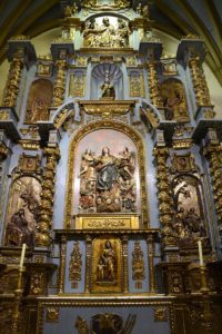
On our way from the vivid street Kote Abchasi (better known with its former name Leselidse Street) with all the cafés and restaurants we found the Sioni church, built in the sixth century. Despite being the main church of patriarch of the Georgian church, the Sioni church is quite small. During the siege by the Persian, the church was transformed into a mosque. The dome is from the 18th century.
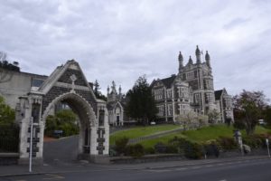
Historical Monuments of Mtskheta / Mzcheta
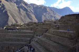
We have included the UNESCO World Heritage Historical Monuments of Mtskhetaon our trip to Stepanzminda. But you can also make a day trip from Tbilisi to Mtskheta (just around 25 km). The UNESCO recognizes the ensemble of churches of Mtskheta as outstanding examples of medieval religious architecture in the Caucasus. We have visited the three main churches: Jvari Monastery, Svetitstkhoveli Cathedral and Samtavro Monastery. The Jvari Monastery will be the first one you will recognize arriving in Mtskheta since it is located on a hill. However, especially the Svetitstkhoveli Cathedral impressed us with its modest interior . It includes a very small church inside that is a copy of the church of the Holy Sepulchre in Jersualem in its former construction. It is said that Jesus’ robe is inside.
Stepanzminda
We spent one night in Stepanzminda to visit the Zminda Sameba Church. The church on top of the hill is a popular place of pilgrimage. As Paul loves to drive everywhere we had – of course – to go by car. However, due to the heavy rain in the night before and the fog in the morning the muddy gravel roads were slippery and with passing buses we decided to turn around and to find the walking path that was described in our guide book. Finally, we reached the church in approx. two hours by foot.
Our way to Mestia
On our way to Mestia we have seen such a colorful landscape the we stopped several times. We enjoyed our tea and snack breaks with a beautiful view on turquoise lakes and mountains still with a bit of snow on the top.
Gelati Monastery
From Kutaisi we visited Motsameta Monastery and the Gelati Monastery since both a just some kilometres away from Kutaisi. Gelati Monastery was the second UNESCO World heritage side we have visited. The monastery was founded in 1106 by King Dawit and consists of three churches, one bell tower and an academy.
Kutaisi
We stayed in Kutaisi for two nights to visit Gelati Monastery and in addition, the city of Kutaisi. Kutaisi has outstanding buildings whereof the Begrati Cathedral just a short walk from the city center belongs together with the Gelati Monastery to the UNESCO World Heritage. The cathedral is more than 1,000 years and and can be seen from all over the city. We will always remember Kutaisi due to the delicious food we enjoyed here. Unfortunately, we do not remember the name of the restaurants but they where in the street from the Colchis Fontaine in the direction to the Kutaisi park.
Mestia
Mestia is the touristic hotspot of Upper Svaneti where the excursions to historic and original towns with medieval-type villages and tower-houses of this Caucasus region can be booked. Arriving in the evening in Mestia after a long day but pleasant drive we walked through the town and tried to catch some nice pictures with all the tower-houses.
Some of the villages and tower-houses are inscribed in the UNESCO World Heritage list (official name is Upper Svenati). Since it was explicitly forbidden to go with our rental car to Ushguli we also had to book a tour with a 4WD car. For the approx. 50 kilometres the drive took almost four hours.
Rabati / Rabath
Something we have not expected to find in Georgia was the historic center and the fortification of Rabati. But Rabati also belongs to one of our highlights of our vacation in Georgia. The fortification consists of a church, a mosque and a synagogue.
Warsia
Arriving in the small town of Warsia, we directly saw our next destination: the cave rock wall of Warsia. The wall is around 500 m high but the paths along the wall are mainly secured with handrails. In the main periods up to 800 monks lived here. In addition, several thousands citizens from the surrounding towns used the wall as a safe haven.
Bolnisi
Around 50 km from Tiblisi in the South into the direction to the border with Armenia, we visited the city Bolnisi. Bolnisi was formerly known as “Katharinenfeld” due to the German settlers around 1818. The area was admired due to the fortified houses as well as the precise and paved roads. The city was renamed to Luxemburg in 1921 and the Germans were dispossessed like the Georgians. In addition, the Germans were forced to displace to Siberia. The road signs are still shown in old German script.
Just some kilometres in the South from Bolnisi we wanted to visit the fortress of Kweschi (Kveshis). It was closed but it looks very nice from the outside.
Traditional dishes in Georgia – our culinary experience
On top of the beautiful country we were allowed to explore, we also enjoyed the food very much. Even so much that we bought the cookbook we recommend below to remind us of the very delicious meals.
Eggplant with walnuts and pomegranate (Nigswiani Badrishani)
Really our most famous starter in Georgia: grilled slices of eggplant, rolled and stuffed with walnut and decorated with pomegranate.
Khinkali – Georgia’s dumplings
These stuffed dumplings made of pasta dough are available all of Georgia. Besides the traditional ones stuffed with spiced minced meat we have also tried the ones with cheese inside. Georgia’S dumplings are bigger than the Chinese ones but also have liquid inside. The knob is to get hold of the Khinkali and it is not intended to eat it. What we by the way, didn’t know at the time we were in Georgia. But nobody told us that we should not eat it.
Chatschpuri – Cheese Bread / Pizza and Lobiani
Eating Chatschpuri you should not think about your diet due to the amount of flour and cheese that is needed for a delicious Chatschpuri. We have also tried Lobiana that is stuffed with read bean paste. Both are highly recommended.
Lobio
What does not sound so special from reading the description was Lobio. But the beans prepared in a clay pot with a lot of savory is incredibly yummy. We also tried this at home but the secret seams to be the preparation method in the clay pot.
Shashlik
Since our vacation in Uzebksitan we are Shashlik lovers. Therefore, it was a must to try it in Georgia. Definitely, we were not disappointed by the meat shashlik as well as by the vegetarian alternative.
Georgian Wine
UNESCO has inscribed the Georgian wine making technique as intangible world heritage. The tradition of wine making is more than 8,000 years old. The grapes and the grape juice are put into a clay pot and buried in the earth for several months with constant temperatures. Almost every guesthouse we have stayed in is creating their own wine.
Our recommendations for Georgia
Georgia travel book
At the time we were visiting Georgia we wanted to have an up-to-date travel guide. This was the reason why we have picked up for one of the first times the guide book from “Reise Know how”. And we can recommend this guide book due to the many travel tips in Georgia, pictures and valid information about best visiting times, restaurant recommendations and well-balanced information about sights and backgrounds.
Georgian cooking book
As mentioned above, Georgia was also a culinary highlight for us. Therefore and since Paul loves cooking at home, we have bought (after a visit of the Frankfurt Book Fair with Georgia as the honored guest in 2018) the following cooking book. The receipts are easy to understand and we were successfully able to re-cook some of the dishes at home.
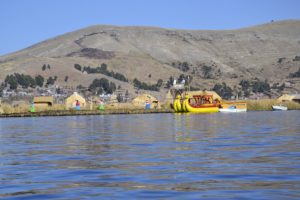
We have been to Singapore twice. The first time we went to Singapore during our all around the world trip. We arrived on the first Christmas holiday in 2016 from Osaka. The second time we have been to Singapore was beginning of 2020 where we arrived from Hongkong and spent a couple of days before going to Malaysia. Based on this experience, we want to share our top travel tips for Singapore.
We spent the days between Christmas and New Year’s Eve on our all around the world trip in Singapore staying with friends. Besides exchanging stories about their and our around the world trip we took some time to explore Singapore. The crew of the Jetstar flight we have taken from Osaka to Singapore has distributed Christmas caps for each passenger. Look how our flight looked like afterwards. The many bags we were carrying on arrival in Singapore are not our normal travel luggage. We have been shopping in Japan presents for our friends and in addition we have left a package in Singapore to send it home together with other staff from our friends.
Singapore Travel Tips
Botanic Garden (UNESCO World Heritage)
Of course, the first thing to see on our list was the botanic garden with its colorful orchids since it is the only UNESCO World Heritage in Singapore.
Enjoying the incredible skyline
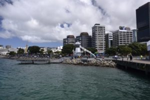
What we have done really every day was stunning at the incredible skyline of Singapore. Yes, we have already visited other cities with skyscrapers and we are living in Frankfurt, but Singapore’s skyline is completely different. The skyscraper have very harmonic forms and fit together very well. Moreover, in the night, the colorful and creative enlighten skyline is something what other cities should learn from Singapore.
Marina Bay Sands & Marina Barrage
Marina Bay Sands has a very impressive architecture with the roof looking like a ship. All three pillars are used as a hotel but also include a shopping mall and a casino. The view from the top at the skyline of Singapore is amazing. Take a walk from the Merlion to the Marina Bay Sands along the Waterfront Promenade to get beautiful views on this hotel complex. The last picture was taken from Marina Barrage. Marina Barrage is a dam built across the 350-metre wide Marina Channel to keep out seawater. In the area around the barrage you can enjoy also a very nice view on Singapore with not so many tourists. Our recommendation: Take a picnic with you and enjoy the light show in the Gardens by the Bay.
Gardens by the Bay
Gardens by the Bay is an artificial and huge park at Marina Bay. One of the highlight of the gardens are the super-trees which are artificially planted with a steel frame. At the time we have visited the gardens in 2016, the Christmas market was still open but due to the weather we preferred cold beer instead of mulled wine. When it is dark the trees flash along the music playing and at the end it starts to snow. This was the moment everybody freaked out and could not make enough pictures. Unforgettable moment since there were so many people really freaking out about the snow. So we did!
Quays
One of our favorite places in Singapore are the quays, namely the Clark and Boat Quay. Walking up and down is something we do every time visiting Singapore.
Singapore’s harbor
We haven’t expected Singapore as being so green with tropical gardens and parks. Look at the view from our friends’ apartment to the harbor.
Little India
More delicious food is available in Little India. The colorful houses also invite for a nice walk through this area.
Singapore has four official languages: Malay, Tamil, Mandarin and English. This is the reason why the main signs are written in these four languages:
Sentosa
We have taken the bicycles to get to Sentosa Island. The island is separated from the main island of Singapore by a channel of water but can easily be reached via the Sentosa Gateway. Formerly used as a British military base, the island was created to be a popular tourist destination. You can find many tourist attractions like fun parks, Madame Tussauds Singapore, and the Universal Studios Singapore. During our visit we were amazed by the houses showing wealth of the people. It’s definitely one of our top travel tips for Singapore.
Our favorite dishes in Singapore
We have tried a traditional Singapore Laksa in a hawker center. Really delicious despite the spiciness…
Besides the Laksa we can recommend the hawker center for satay, Hainan chicken or the many different dishes from all over the world offered in the centers.
Our book recommendations
Travel books
The first time we have been to Singapore we have bought a comprehensive travel book about Singapore.
The second time we have relied on the combined Malaysia and Singapore travel guide.
If you are interested in a novel, we can recommend Foreign Bodies – a tale of young people who are on the wrong side of the justice system in Singapore.
Welcome to our travel guide for globetrotters & UNESCO enthusiasts – discover the top travel tips for Japan – we promise to you that you will love Japan’s culture, architecture, landscapes and the exceptionally delicious food.
The first time we visited Japan was on our all-around-the-world trip in December 2016. On 7th December 2016, we arrived in Tokyo – back on earth’s northern hemisphere for a long time. Just sweated in Australia at 35 degrees – now freezing in Japan at minus 2 degrees Celsius with the first snow flakes we had in Nikko some days later. From Cairns we have taken a Jetstar Asia flight to Tokyo that took around eight hours. This was our first flight with Jetstar Asia and we can really recommend this low cost airline since we had afterwards a couple more with Jetstar. Our flight to Tokyo was around St. Nicholas’ Day what prompted the airline to distribute Nicholas hats…
Japan is a cultural shock after the extrovert Latin Americans and the very communicative New Zealanders and Australians. From a technological point of view we can learn a lot: hot coffee cans from vending machines, heated toilets, easy system to choose the dishes without knowing the language… and these are only the things we have discovered in our first days here.
Our route through Japan
We stayed 18 days in Japan and tried to see at last some of the cultural highlights in that timeframe. Nikko was our most northern point and from there we drove to the South with the hope to have a little bit of warmer temperatures.
Our experience of self driving in Japan
For renting a self-driving car we needed a Japanese translation of our international driver licenses. This is available at the Japan Automobile Federation (JAF) for around 30 Euros per driver license. This lasts approx. one day so plan enough time before picking up the car. It is not surprising that Japan is expensive. But we were astonished paying the highway fee for 150 km from Tokyo to Nikko with approx. 40 Euros. Based in our plan to drive more than 2,500 km this will sum up to a huge amount.
The amount of money we have spent for toll and parking surprised us definitively: about 500 euros for toll and additional 150 Euros as car parking fee. We had several hotels without free parking. Next time we will also check this option at booking.com. This is in total more compared to the amount we have spent for our meals in Japan. Also other countries had a toll system but this amount exceeds everything what we have experienced so far, e.g. in Chile for comparable number of kilometers we only paid 80 Euros.
We got a typical Japanese car as rental car and it looks like a shoebox. However, we have to admit that the car is practical: in which other car – despite our campervan – is it possible to walk from the front to the back inside the car? But with this car it doesn’t matter that the maximum speed on the quite empty but three lanes highway is only 80 to 100.
Our travel experience and travel tips for Japan
Tokyo
We have started our tour through Japan in Tokyo. Despite our itinerary being fully packed for the three days, we are sure we have not seen all interesting sights of this huge metropole with more than nine million residents. But the metro is very efficient and a fantastic way to get around with trains running every three to five minutes and it’s many different lines. We were surprised seeing not so many people on the streets in the city and cars on the streets as expected in such a populated area. Exciting is also the mixture of traditional temples and fancy skyscrapers.
Kyu-Shiba-rikyu Gardens Tokyo
We started our exploration of Tokyo with a typical Japanese garden. The one we have chosen is close to the Hamamatsucho station. This small beautiful garden allows you to get a sense of what a typical Japanese landscape garden incl. a lake with koi fishes is like in a fairly short amount of time, and is a great place to stop and take a break from the surrounding metropolis. This garden is one of the oldest one in Tokyo. From this park you can also see one of the first skyscraper of Tokyo – the World Trade Center.
Zojo-ji Temple
From the Kyu-Shiba-rikyu Gardens we walked further to the Shiba park with the temples Zojo-ji. The temple was founded in 1393 and is the main quarter of this Buddhist school. At the end of the temple area you can see many small stone figures wearing a red knit hat. These are for deceased early in life children. According to Japanese folk belief, red is the color for expelling demons and illness. The red heads shall help the children in their afterlife.
Tokyo Tower
In the pictures from the Zojo-ji temple you might have already seen the Tokyo tower with its red and white stripes that looks like a copy of the Eiffel tower in Paris. However, if something is copied in Japan, it needs to be better than the original. Therefore, the Tokyo Tower is with its 333 meter around 13 meters higher than the original but has only half of the weight. The tower was finished in 1958. We have taken the escalator up to the viewing platform in 150 meters and enjoyed the incredible sweeping view of Tokyo. There is even a visitor deck at the height of 250 meters however, the view on the 150 meter deck is said to be better.
Shinjuku district
This district combines much of the things that will come to one’s mind when thinking of Tokyo: upscale department stores, swarming crowds, video screens on the streets, amazing skyscrapers with hidden shrines in-between. The train station is used by 2-3 mn commuters every day and is therefore one of the busiest in the world. Tokyo’s municipal government has also moved in this area in 1991. Some really photogenic towers can be seen in that district, like the Mode Gakuen Cocoon Tower.
47 Ronins of Ako or Ako Gishi / Sengaku-ji
The graves of 47 samurais are located in the temple Sengaku-ji. This grave site is more than 300 years old.
Shibuya Crossing and area
This crossing is an awesome spectacle with giant video screens… Around the crossing you will see numerous neon signs and video screens in an almost uncountable number. Unbelievable also the number of people crossing here every second.
Happo-en Garden
Another traditional garden we recommend to visit in Tokyo is Happo-en. The well-manicured grounds are home to centuries-old bonsai trees, a koi pond, and cherry trees and fall foliage that make for some of the best seasonal views in the city.
Edo Castle / Tokyo Imperial Palace
Unfortunately, we were too late and could not visit the Tokyo Imperial Palace from the inside. Formerly, this castle was the largest in the world though little remains of it apart from the moat and walls. In the garden you can see the massive stones used to build the castle walls end you can even climb on the ruins. The Imperial Palace is surround by a moat. Several bridges and a gate give you access to the grounds.
Senso-ji in Asakusa
Senso-ji is one of the most important and oldest temples in Tokyo in the district Asakusa. The entrance to the temple is via the Kaminari-mon (thunder gate) that brings you directly to the shopping street. Passing the street you reach the five-level pagoda and the temple itself with the sink in front of it.
National Museum (UNESCO World Heritage)
The National Museum consists of several separate buildings in the district Ueno. We visited the main Gallery (Honkan) with a ancient pottery, religious sculpture, samurai swords, kimonos and much more. One of the buildings is registered as UNESCO World Heritage as part of the ensemble of the architectural work of Le Corbusier that shows an outstanding contribution to the modern movement.
Jyo Myo In and Daienji Temple in Yanaka
The last temple we would like to recommend to you is the Jyo myo In temple in Yanaka. This temple includes more than 84,000 Jizo stone figures.
From there it is just a short walk to the Daienji temple. They were about to close at that time we arrived here but also the outside was very beautifully constructed.
Nikko (UNESCO World Heritage)
Temples and shrines in Nikko are from the 17th century and it is said that you should not say gorgeous before seeing Nikko. We can confirm that this is true and cannot imagine seeing temples being more impressive. The temples and shrines of Nikko (Tosho-gu) are inscribed to the UNESCO World Heritage list due to its architectural and decorative masterpiece. Left to the entrance you can see the famous “hear no evil, see no evil, speak no evil” monkeys that demonstrate the three principles of Tendai Buddhism.
Traditional guest house in Nikko (Ryokan)
We also wanted to try the traditional way of guest houses. For the first time, we have chosen one in Nikko. Ryokans are nowadays famous for delicious food, well maintained Japanese gardens, onsen bath and courtesy service. Even though the rooms are at the first glance very plain with its straw mats lying o the ground, flat tables with seat cushions, the private onsen and the authentic food compensate for everything.
Tomioka Silk Mill (UNESCO World Heritage)
On our way to the sacred mountain Fujisan we visited a silk mill from 1872 – at that time Japan started a modernization of the country. To set up the Tomioka Silk Mill, Japanese government employed technical advisers from France. However, the recruitment of local workers was not successful at the beginning since it had been rumored that the French would drink blood. The Japanese have seen the French people drinking red wine and they had mistaken this for blood. Even the government denied this rumor and emphasized the importance of the mill, this lead to three months delay in starting to operate the mill.
The Tomioka mill was used for 115 years and played an important role for Japan in high quality raw silk manufacturing. In some shops next to the mill they sell a kind of thick cream what we have identified later as silk ice cream.
Kamakura
From the silk mill we have made a stop-over in Kamakura. This was rather planned only for sleeping but we found the Tsurugaoka Hachiman-gu shrine that was illuminated in the night. It was already closed but we have taken the opportunity for a short walk around the area.
Fujisan (UNESCO World Heritage)
Japan’s highest mountain with around 3,700 m is Fujisan. Due to its symmetric cone, Fujisan is the mountain that is most mentioned in Japanese literature and at the same moment it is a holy mountain playing an important role in the Buddhism. Unfortunately, we were not lucky with the weather and were not able to see the mountain – except on picture postcards.
Going up the first 1,500 meters by car is possible in general. Received the required information for driving up from the visitor information center, we paid the entrance fee and started driving up the mountain. At the first of five stations, we were stopped by the security since the road was closed due to the weather conditions. At least a piece of the road was paved with an asphalt creating a nice music when driving on it.
Japanese Alps / Shirakawago (UNESCO World Heritage)
We continued our trip into the Japanese Alps to Shirakawago. This is one of the snowiest places in Japan with up to 10 meters snow per year. Therefore, the houses have special rooftops: peaked and with thick thatch covered rooftops. This construction allows rain and snow to fall straight off and prevents the water going through into the house. The houses look a bit like houses in the German Black Forest region.
Kanazawa / Kanazawa Castle Park
The city Kanazawa was mainly established in the late 16th century by one family. The latter invested in building a fortress (to ensure independence from the former Edo regime) and a huge Japanese garden. Main parts of the fortress have been re-built until 1990. The garden is called Kenroku-en and means that six important attributes of the garden are fulfilled: water, outlook, range, feeling of security, inviolacy, arrangement.
But everything in this garden is artificial and based on an exact planning – even the water is coming through 10 km long pipelines. However, it is a very cozy park where we have met a very friendly park ranger who has created an Origami paper crane for us.
In Kaga we stayed again in a traditional guesthouse (Ryokan). This time it is was a larger one with some entertainment program in the evening.
Uji (UNESCO World Heritage together with Kyoto)
Uji is a small city to the south of Kyoto and belongs to the UNESCO World Heritage of Kyoto. Byodo-in is a Buddhist temple that was converted from a villa in 1052. The only remaining building is the Phoenix hall. The Phoenix was a popular mythical bird in Chinese and was revered by the Japanese as a protector of Buddha.
Kyoto (UNESCO World Heritage)
Kyotowill always remain in our memories as the colorful temple city. With more than 2,000 religious places Kyoto is a proud cultural city. Kyoto was after Nara the second permanent capital of Japan and the 1,000 years of being an imperial city has left cultural heritage en mass. 18 sites in and around Kyoto are recognized as UNESCO world heritage including many shrines and temples as well as the castle of Kyoto. The huge temples have many wooden carvings. The red and orange temples are shining in the sun and the golden temple is completely covered with leaf gold. Impressive temples!
We visited Japan the first time in December 2016. The Christmas lights in Kyoto were really impressive and we have taken the illuminated road couple of time 😉
Kyoto – the city of shrines and temples – is like Japan in perfection and therefore, a mandatory bucket on your travel itinerary. We spent in total three days in Kyoto and would like to stay even more to explore the whole city. The number of sights is incredible, therefore, we will present the most beautiful ones which we have visited.
Kiyomizu-dera temple
We have started in the morning with a walk up the hill to the Kiyomizu-dera temple. From there you can enjoy a good view over Kyoto. Like other temples this one also consists of several buildings.
Kinkaku-ji – the golden temple
This temple might be the most popular one in Kyoto. The upper levels are covered with gold leaf. The sight of the temple reflected in the pond is simply beautiful. Walking through the garden is the only possibility to visit the temple.
Ryoan-ji temple
A beautiful and quit empty Zen temple is Ryoan-ji. The long aisles with the typical Japanese windows and the gardens are very good for taking pictures.
Ninna-ji
Only a short walk from Ryoan-ji you can visit the Ninna-ji temple with a beautiful five-storied pagoda. The pagoda together with the great gate Nio-mon and the main hall Kondo Ninna-ji is considered as a national treasury.
Higashi-Hongan-ji
Close to Kyoto’s central station lies this Jodo-Shinshu temple founded at the beginning of 13th century. The main and the founder hall belongs to the largest wooden buildings in the world.
Nishi-Hongwan-ji
This temple can be visited together with the previously mentioned Higashi-Hongan-ji since it has been re-located to a site near-by. The temple halls and gates are decorated with elaborate carvings.
Last but not least: Chikurin-no Komichi
This is not a temple but a lovely bamboo grove (path of bamboo). Really impressive to see how this hard wood bamboo is growing.
Nara (UNESCO World Heritage)
Nara was the first permanent capital of Japan with several UNESCO World Heritage sites. The centerpiece of ancient Nara is definitively the Great Buddha that is housed in Todai-ji. But you must not leave the deer park out of your itinerary when visiting Nara. Nara can be visited as a day trip from Kyoto due to the express railway.
Nara park
A special experience on our trip is the encounter with animals we so far only knew from the zoo. In Nara we visited the Nara park crowded with deer without any fences. The deer are used to people. When somebody buys the offered special deer cookies, they start running towards the cookie owner. But selfies without cookies seem not to be their favorite… About 1,200 deer are living in this area. The deer were in pre-Buddhist times considered messengers of the gods and therefore enjoy the status of National Treasures.
Todai-ji
The deer are around the temple of Todai-ji. The temple itself is the largest wooden building in the world. This huge temple is necessary for the 16.2 meters high Great Buddha (Daibutsu) statue inside. Its Buddha statue is one of the largest bronze figures in the world and was originally cast in 746. The present statue with its 15 meters consists of 437 tones of bronze and 130 kg of gold. Several halls are around he main temple hall.
Horyuji (UNESCO World Heritage)
In the Horyuji area 48 more Buddhist buildings where some of them date at the late 7th or early 8th century, making them some of the oldest surviving wooden buildings in the world. It is therefore the oldest temple in Japan and a repository for some of the country’s rarest treasures. This area is still within the Nara prefecture and can be visited from Nara in a single day. But we experienced the ticket fee for this temple very high so to be really worth it you should rather plan half a day.
Koyasan (UNESCO World Heritage together with half island Kii)
Back in Japan’s mountains at around 900 meters we visited Koyasanwhich is one of the most famous pilgrimage place. One quarter of the residents of Koyasan are monks. The oldest temple is from the year 816 and several hundred thousands graves are located in the cemetery next to the area with 120 houses, shrines and temples. Some temples had to be rebuilt already five times due to fire. Koyasan is impressive from the natural setting and the vast cemetery (Oku-no-in).
Cemetery of Koyasan
Sacred Precinct of Koyasan
Niutsuhime Shrine and Jison-in Temple (UNESCO World Heritage)
The Niutsuhime Shrine belongs to the ensemble of UNESCO World Heritage of Koyasan & Kii and the pilgrimage route. If you climb the stairs from Jison-in Temple, you can reach a shrine, which is said to be the starting of the pilgrimage trail.
Himeji Castle / Himeji-jo (UNESCO World Heritage)
The most significant wooden building in Japan is Himeji Castle. Its first fortification was built on this site in 1333 and gradually enlarged over the centuries by various clans ruling over this region. This castle complex as it survives today is over 400 years old and was completed in 1609. It comprises over eighty buildings spread across a wide area connected by a series of gates and paths. The main building is 92 meters high and one of the reasons why this is castle is stunningly beautiful is the roof covered alternating with flat and round tiles with crests of the ruling families.
Himeji Castle is recognized as UNESCO World Heritage since it is the finest surviving example of early 17th-century Japanese castle architecture. It is possible to visit this castle as a day trip from Nara, Kyoto or Osaka or this is how we did it, as a stop-over on our route to Hiroshima.
Kurashiki
From Himeji to our next destination Hiroshima, we stayed for one night in Kurashiki. Kurashiki surprised us with a picturesque area with old willow-edges historic buildings along the canal. The warehouses were used to store rice and later for textile.
Hiroshima (UENSCO World Heritage)
Hiroshima is best known as the first city in history to be targeted by a nuclear weapon when an atomic bomb was dropped at 8:15 am on August 6, 1945.
Genbaku Dome
The museum shows clothes and personal items like children’s bicycle and watches after the bomb explosion. Unimaginable is the heat of the explosion so that also glass and stones melted. Approximately 80% of the buildings in the city were destroyed including Hiroshima’s castle and temples. The Hiroshima peace memorial park is located in the city center. On the opposite, the formerly building of the Hiroshima Prefectural Industrial Promotion is located. This is now called Hiroshima Peace Memorial (Genbaku Dome) and was the only building left over in the hypo-center of the atomic bomb.
Hiroshima Castle
The castle was rebuilt until 1958 as a replica of the original and now serves as a museum. It is surrounded by the Hannover garden that was built due to the city partnership with Germany’s Hannover.
Miyajima / Itsukushima Shrine (UNESCO World Heritage)
Probably the most famous picture from Japan is the red gate standing in the sea in front of a shrine and mountains in its rear. Therefore, it is one of Japan’s most visited tourist spot. This Shinto Itsukushima Shrine is recognized as UNESCO World Heritage. The gate is about 16 meters height and the roof is 25 meters long so that we saw the gate already from the boot.
This is part of the MiyajimaIsland near Hiroshima. The Itsukushima Shrine is dedicated to the goddesses of the sea, traffic safety, fortune and accomplishment. It was first built in 593 and remodeled into the current structure in 1168 and comprises the main shrine, a drama stage, music rooms and halls as well as other shrines. All the rooms are connected by wooden and covered corridors of about 300 meters enabling our visit during long lasting rain showers. The target of the color is to keep evil spirits away from the shrine. During flood it seems that the shrine is floating.
Hagi (UNESCO World Heritage)
Monuments of the era when changing from traditional Japan into a modern and industrialized Japan are spread all over the country. We have found parts of an oven used for melting iron and an old port constructing western style ships in Hagi in the South of the main island. Hagi is part of the UNESCO sites of Japan’s Meiji Industrial Revolution: Iron and Steel, Shipbuilding and Coal Mining.
Iwami Ginzan (UNESCO World Heritage)
The Iwami Ginzan Silver Mine in the south-west of Honshu Island is a cluster of mountains, rising to 600 m and interspersed by deep river valleys featuring the archaeological remains of large-scale mines, smelting and refining sites and mining settlements worked between the 16th and 20th centuries. In the 17th century it was the most important silver mine in Japan producing around a third of the world’s silver every year.
The site also features routes used to transport silver ore to the coast, and port towns from where it was shipped to Korea and China. The site is spread along a valley with an approx. 2 km walking path leading to the mine shafts, temples, historic residences and ruins. At the far end you can go through the Ryugenji Mabu Shaft. This shaft has been enlarged to enable the tourists passing through.
In this area we found funny toilet signs:
Izumo
Just some kilometers from Iwami Ginzan is the great Izumo Taisha shrine located. This is one of the most important shrines of Japan since the shrine is also telling much of Japanese history. Twisted straw ropes hang over the entry to the main buildings. Those who can toss and lodge a coin in them are said to be blessed with good fortune.
Osaka
We spent our last day in Japan in Osaka which is a big trading city due to its industry and its port. Osaka has a lot of rivers and canals and is therefore also known as “Venice of the East” and “city of 808 bridges”. Opposite to the giant skyscrapers like the blue crystal tower a huge Japanese castle is located on a hill. The Osaka castle is originally from the end of the 16th century but as other cultural buildings in Japan it was destroyed several times so that the current castle is from the 20th century. Unfortunately, we only had half a day in Osaka but will the next time stay longer in Osaka.
Despite the language barrier, going out for lunch is easy since many restaurants have plastic models of their dishes and you order and pay via a machine and just hand over the ticket to the waitress. We have not yet waited more than five minutes until the lunch was served.
We have found the origins of this fake food – there are stores selling only these plastic food / meal models!!!! You can find there everything from separate sushi over complete Japanese dishes, Italian noodle dishes, ice cream to glasses of beer. Incredible to see this.
100 Yen cold and warm beverages vending machine
Besides the usual cold drinks from vending machines we enjoy the hot cans of coffee from these machines. This was one of my personal favorites in Japan and always thought how helpful this would be at train stations at least in Germany when freezing in the winter time.
Japanese Breakfast
However, the Japanese breakfast with miso soup, a lot of garlic and grilled fish is for me a bit crazy….
Saskia Hohe’s breakfast in Japan
Shabu Shabu
Shabu-Shabu is a delicious kind of fondue but with two different soups, very thin sliced meat (1.4 mm) and a lot of vegetables.
Okonomiyaki
Japanese pizza is a specialty in Hiroshima and Osaka consisting of layered noodles, cabbage and pork, prepared on a hot stone.
Ramen
Throughout our route in Japan we had different traditional Japanese Ramen as lunch – and we were never disappointed.
Samurai eight-course dinner on Christmas Eve
Back in Kyoto on Christmas we enjoyed a samurai eight-course dinner with typical meals of the samurais. It included Japanese soy beans, pickles, raw fish, fried tofu, beef, pork belly and green tea tiramisu – everything what gives power and enables a long life.
Final note on Japan
Our 18 days in Japan are already over but we enjoyed every day in this beautiful and very clean country even with some days being rainy and having snowfalls in the mountains. The cultural heritage is amazing huge and incredible colorful. Although the days were quite short due to the winter time, the speed limits on the streets and the crowded cities we have seen a lot of sights while driving around 3,200 km.
The majority of people we met spoke at least a bit English and many of them could also speak some words in German what surprised us. Japan was the last country with a rental car for the following two months. In the other South East Asian countries renting a car is not possible for foreigners. This means we have to reduce our luggage from around 35 kilos in order we can easier walk around and travel by bus with all of our staff. It seems that the Japanese language sounds to us the same way unfamiliar as Spanish in the beginning in Latin America. Otherwise we cannot explain why we always answer in Spanish when the Japanese ask or explain us something.
Our book recommendations
Travel Guides
Lonely Planet Japan is your passport to the most relevant, up-to-date advice on what to see and skip, and what hidden discoveries await you.
Lonely Planet’s Best of Tokyo is your passport to the most relevant, up-to-date advice on what to see and skip, and what hidden discoveries await you. Sample the finest sushi or most satisfying bowl of noodles you”ll ever taste, explore the neon nightlife of Shinjuku, and find the best view of Mt Fuji.
Novels
Journey Under the Midnight Sun: Stark, intriguing and stylish, Journey Under the Midnight Sun is an epic mystery by the bestselling Japanese author of The Devotion of Suspect X.
The English-language debut of an exciting young voice in international fiction, selling 660,000 copies in Japan alone, Convenience Store Woman is a bewitching portrayal of contemporary Japan through the eyes of a single woman who fits into the rigidity of its work culture only too well.
The Gun – A Tokyo college student’s discovery and eventual obsession with a stolen handgun awakens something dark inside him.
Yakuza Moon: Memoirs of a Gangster’s Daughter – Born to a wealthy and powerful yakuza boss, Shoko Tendo lived the early years of her life in luxury. However, when she was six, everything changed: her father was jailed, and the family fell into debt. Bullied by her classmates because of her father’s activities, and terrorized at home by her father, Tendo rebelled. As a teenager she became a drug addict and a member of a girl gang.
Culture Smart! Japan will guide you through modern Japan’s shifting social and cultural maze. It provides invaluable insights into people’s attitudes and behavior, and practical tips to help make your visit to this complex, rich, and dynamic society a mutually rewarding experience.
Cookbooks
Ramen – From backstreet Tokyo diners to the hottest establishments in LA, via the chic laid-back ramen bars of London’s Soho, you will find the most complex of flavor combinations, all in a single bowl. Including 50 mouth-watering recipes, from homemade broth and noodles to complementary dishes and sides s, this cookbook will transport you to the vibrant streets of Japan via your own kitchen.
Now, for the first time, Itoh’s expertise has been packaged in book form. The Just Bento Cookbook contains twenty-five attractive bento menus and more than 150 recipes, all of which have been specially created for this book and are divided into two main sections, Japanese and Not-so-Japanese.
Japan: The Cookbook has more than 400 sumptuous recipes by acclaimed food writer Nancy Singleton Hachisu. The iconic and regional traditions of Japan are organized by course and contain insightful notes alongside the recipes. The dishes – soups, noodles, rices, pickles, one-pots, sweets, and vegetables – are simple and elegant.
An overview of our route through Chile – details are shown in the following maps below:
Easter Island
Our first stop in Chile was the Easter Island. A magical island with the famous statues made of stone (called Moais) that is about 3.700 km away from Chile’s mainland and around 4.000 km from the next bigger island. From a geographical point of view, Rapa Nui (original name of Easter Island) belongs to Polynesia but as a territory it was annexed by Chile in 1888. It is almost in the middle of nowhere but a very nice and interesting part of the world. The island with the only one city “Hanga Roa” looks like a triangle with a length of 24 km and width of 12 km.
The Moais are made of stone from a volcano, all having big heads, long noses and ears and looking almost the same but differing in size from two to almost ten meters. They are spread at different places all over the island like an open-air museum.
Easter Island, Chile
Easter Island, Chile
Easter Island, Chile
After long days sitting in cars on our tour so far, we decided to rent bikes for the two full days we stayed on the Easter Island. Starting from Hanga Roa, we started our tour of about 60 km with hiking up the hill in the south to Orongo where ancient houses from the Rapa Nuis are shown. After that we cycled along the whole coast in the south to Rano Raraku – the volcano from which the stone for the Moais was taken. In this area, Moais in different production status can be visited. Amazing how the Maois have been transported to the coast in the time of 1100 AC – different theories exist from transporting with wooden sleighs to walking tied with slopes.
All except of seven Maois are looking to the inner island and with the back to the sea to establish a connection between the population and the ancestors. The story behind the seven Maois looking to the sea is that these are memorials for seven explorers to find a new island for the increasing population.
Saskia Hohe Bicycle tour Moais on Easter Island, Chile
We only stayed three days on the Easter Island with every day totally different wheather:
day of our arrival: Sunny with a bit of rain
day 1: Sunshine with 30 degrees Celsius
day 2: Heavy rain showers the whole day
day of our departure: Storm
Due to the rain on our second day, we had to rent a car again to see the residual parts of the island.
Calama
Back in Chile, we flew from Santiago de Chile to Calama in the north of Chile. Chile is with its 4.300 km pretty long so that driving would have taken several days to reach the north and also Patagonia in the south. The following map shows our destinations in the north of Chile:
Valle de la luna
The region in the north remembered us of the southern parts of Bolivia and Peru due to the high mountains, the salt desert and the sand dunes in the Atacama desert. The main city in the Atacama desert is San Pedro with only mud brig houses but hundreds of tourists surrounded by 5,000 to 6,000 m high volcanoes. As the name suggests, in the “Valle de la luna” it looks like on the moon. The white spots on the picture is salt. This area is very dry and hot during the day with very cold nights. Therefore, no vegetation is able to survive here.
Valle de la Luna, Atacarma desert, Chile
We have never seen so many houses with national flags on residential houses like in Chile:
Iquique
We continued our tour to the coast in the north of Chile with the destination Iquique. It was absolutely surreal driving on the relatively flat section at the end of the Andes mountains after the twisting roads in Peru. We really enjoyed the straight road with good views of the opposing traffic and hardly any intersections.
Iquique surprised us with the skyscrapers – and it looks a bit like our home Frankfurt. Iquique with its port was very important during the time of saltpeter and the houses built between 1880 and 1930 have been maintained.
Santa Laura and Humberstone
Around 40 km from Iquique, the UNESCO ghost towns Santa Laura and Humberstone were on our agenda. Both towns give an impression how life was when working in saltpeter mines and living next to it. The towns have been completely abandoned in 1960 after the saltpeter mining was not profitable anymore as the synthetic production increased. During our visit we could still smell the saltpeter in the air.
Valparaiso
Central Chile is famous for its wineries, street art and beaches. Chile is one of the sixth biggest wine producing country and also rare grapes are growing here. Valparaiso, the colorful and chaotic city with its hills, is only around 100 km from Santiago at the western coast. We have never seen so many stairs within a city. The elevators to facilitate climbing up the hills are recognized as UNESCO world heritage and are from the time between 1883 and 1916 whereof some of them are still in use. Widespread in the city colorful and nice paintings at the houses can be seen. The houses themselves are quite old but wonderfully maintained. We stayed two days in Valparaiso in a house that is 127 years old and also some furniture looked like in a museum.
Colchagua Valley
The Colchagua Valley in Central Chile is one of Chile’s best known wine regions. Located 130 km southwest of Santiago, the vineyards are naturally protected by the Andes Mountain Range to the east and the Coastal Mountain Range to the west. This constellation with quite dry all over the year, winds from the Andes and the maritime climate provides optimal conditions for growing the grapes. We made a guided tour (http://www.naturalwinetours.com/en/) through the winery Montgras which has received many awards for its Carmenère, Syrah, Malbec and Cabernet Sauvignon wine. Especially, the Carmenère is a typical Chilean wine which is mainly growing here due to the conditions mentioned above. We started our tour with a mountain bike tour through the vineyard and a visit of the manufacturing center including tanks with several ground liters of wine and ended with a tasting of different wines together with the experiment how the wine tastes vary when eating cheese or sausages in parallel. It was an interesting and amazing tour and a special thanks to our wonderful guide Gonzalo the co-founder of Natural Wine Tasting who explained us everything in English, let us try the wine directly from the tank and made this visit a special event we will definitively not forget on our trip around the world. We will try to get the wine when back at home since it seems that the German importer is selling the wine from this winery to REWE.
Bicycle tour through Montgras in Santa Cruz
Winery Montgras in Santa Cruz in Chile
Winery Montgras in Santa Cruz in Chile
Winery Montgras in Santa Cruz in Chile
Winery Montgras in Santa Cruz in Chile with Gonzalo – Thank you for the lovely tour! More information can be found here: http://www.naturalwinetours.com/en/
Central Chile – Osorno and Santa Cruz
In Central Chile we almost felt like being at home with the green fields and forest next to the two lanes highway in a very good condition without the curves we used to had in Bolivia and Peru. In addition, this is the area where a lot of former Germans are living due to a population project by Chile at the end of 18th century. And in recent times some Germans started microbreweries with Bavarian beer and food what we had to taste of course.
Winery Montgras in Santa Cruz in Chile
Winery Montgras in Santa Cruz in Chile – restaurant Bavaria
Germans in Chile (Osorno)
The next destination in Chile was the biggest island or better group of islands Chiloe with its wooden churches all over the islands. Besides the airplane we used to get to the north of Chile and our rental car we used ferries to get to the islands. The islands are with 9,322 km2 and 150,000 residents much bigger than the Easter Island.
16 out of the over 150 wooden churches from the 17th and 18th centuries are recognized as world heritage by the UNESCO. The outer walls are covered with colorful wooden shingles and also the interior is completely made of wood.
North Patagonia
We spent 1.5 days on ferries and in the car (including a night) to visit the North Patagonia. Amazing and mainly untouched landscape. We have not expected to see such a green landscape with so many trees and fern. Parts of the Carretera Austral are paved but we had some challenging sections where we struggled to get through with our small car that we have in Chile – especially due to the heavy rain showers we had during the time. We have not seen a gas station and the ports for the ferries are just the end of the road without nothing else.
Our tour through the Central and the Southern regions of Chile
Puerto Vargas and Puerto Octay
Back in Chile’s “small South” we started our way back to Santiago (around 1,050 km) and visited in more towns, especially Puerto Vargas and Puerto Octay that were characterized by Germans. Besides the plan from Chile to populate the sparsely populated regions to protect them against acquisition, the immigration process of Germans was started by two brethren from Rotenburg an der Fulda in Heese. They bought one region in 1845 and brought nine families of handicraftman in the next three years. Based on the promised advantages of several years not paying taxes and parts of the countryside and the advertisement for Chile, the brethren could win around 600 people more until 1851 for the immigration to Chile. The oldest German school in Latinamerica was founded in Osorno (see above) in 1854. Until 1870 approx. 6,000 Germans were immigrated to Chile and settled mainly in the region around Osorno and Validivia. No wonder that we found a cafe with the name “Hessendorf“.
We spent five days in Santiago de Chile – which are our last days in Chile after three weeks and at the same time our last days in South America before we are changing the side of the world to New Zealand. Buildings from the colonial area like in other capitals in Latin America are rare due to the many earth quakes and the economic wealth Santiago achieved only after the independence of Spain.
Saskia Hohe in Chile de Santiago de Chile
Due to the long coast fish and sea food is very typical for the Chilean cuisine. In Santiago, the “Mercado central” is a fish market together with restaurants. Some of the fishes especially the crabs were still alive.
On August 11th 2016, we are flying from Panama City to Quito / Ecuador. During the last days staying in Panama City we planned the route across Ecuador and decided to take the Panamericana through the Andes with all the sights and national parks next to it. With Quito being 2.850 meters above sea level, Latacunga and Riobamba around 2.700 meters and Cuenca in the south with 2.500 meters, the eleven days we are staying in Ecuador will be a good altitude training for us.
One of our mornings in Quito started with a surprise:
Car rental in Ecuador
Car rental in Ecuador
and then the adventure with our rental car company started: we suggested just to have a new replacement tire what they tried to do. But of course, they first had to analyse what was the issue with the broken tire. Then they recognised that they do not have an adequate replacement tire for us. This meant we had to change the car (of course after filling up the tank by ourselves) – but what they gave us was EXACTLY the same type of car with the same size of tires!!!! However, self driving is not an issue in Ecuador but you need to be patiened to get into the cities in the evenings.
Quito
On our first day in Ecuador, we visited Quito by a long and exhaustive walk through the historic center of Quito. Since not only Quito is on a high altitude but also in Quito itself it goes up and down everywhere the walk was very challenging for us… However, the climate is more comfortable compared to Panama due to the height.
Quito is the highest capital in the world and the first capital recognised as world heritage by the UNESCO. Quito is a beautiful city with many churches from the colonial area and many of them completely with gold leaf. In one of the churches we found a picture from the last Supper where a guinea pig was served.
Quito
Quito
Quito
Quito
To see the Virgin of Quito we walked up a hill where we had an amazing view over Quito. Besides the walking on the particular altitude also the “muchos perros” were a challenge for us.
Virgin of Quito
Virgin of Quito
Tradiitional dance in Ecuador
As the name Ecuador suggests, the equator goes through the country: just around 30 kilometers in the north from Quito.
Cotopaxi
After spending 3.5 hours in the rental car company we started our trip to the south with a stop at Cotopaxi volcano and spent the night in the small town Latacunga.
Volcan Cotopaxi, Ecuador
Volcan Cotopaxi, Ecuador
Volcan Cotopaxi, Ecuador
Volcan Cotopaxi, Ecuador
We would like to show you more pictures of Ecuador’s landscape however, we are not lucky with our rental car. After the issue with the tire yesterday, our car stopped suddenly in the middle of a road when we passed a small town. The nearest service station was not able to fix the issue so we had to contact the rental company to organise a towing service. It ended up with six hours waiting for the towing service, driving to the service station, discussion with the rental company whether we get again a new car or repairing and in the end getting the broken fuel pump repaired. We arrived in our destination Riobamba without the sights planned for this day and after the sun went down already. So, we are keeping the fingers crossed that tomorrow is a day where we will not need to visit our rental car company 🙂
On our tour through the Andes we stopped in several cities, like Guamote, Alausi, Latacunga and Salina. All cities were surprisingly not that small and under-developed as we have expected. Especially almost all roads were paved and the Quito-Cuenca highway has three lanes with lights in the night. But most of the people on the countryside are still wearing the traditional clothes:
Cuenca
The southern end of our tour was Cuenca – a beautiful colonial city similar to Quito:
Cuenca
Cuenca
Cuenca
Cuenca
Cuenca
Cuenca is famous for the Panama hats that were invented and are still produced here. We tried some hats for several hundred dollars but (besides the cost) due to the many luggage we already have we decided not to buy another one.
Panama Hat Musuem n Cuenca
Panama Hat Museum in Cuenca
Panama Hat Museum in Cuenca
Panama Hat Museum in Cuenca
Panama Hat Museum in Cuenca
Saskia Hohe with Panama Hat
We also found interesting traditions of eating in Ecuador:
Guinea pig in Ecuador
Pig in Ecuador
The nature and the landscape with the vulcanos is amazing all over the Andes in Ecuador. In the national parks and on “normal” roads we were able to get quite close the vulcanos on high altitudes around 4.200 meters.
Let`s keep the fingers crossed that we have not violated traffic rules:
How we got to New Zealand from Chile (on our all around the world trip)
After more than 14.500 km self-driving in South America and an overnight flight of 13 hours from Santiago de Chile we arrived on 19th October in New Zealand. In the light of the very pleasant flight with a really good service we can recommend flying with LATAM on this direct connection. Due to passing the International Date Line we almost lost the complete day of 18th October 2016. Above all 13 hours sounds a lot but compared to when flying from our home country Germany to New Zealand it was rather a short flight. Read on and discover the top travel tips for New Zealand by campervan.
Our route through New Zealand
North Island
Arriving in Auckland, we directly picked up our Apollo campervan at the station. Consequently, we started in the North Island of New Zealand (Auckland) and took a ferry to the South Island. During our trip we have heard that this is the favorable direction (from North to South). Consequently, picking up the campervan in the South and returning in the North is cheaper in general.
South Island
In total, we drove around 4,850 km in New Zealand with our big vehicle. It’s not really a big issue due to the mainly empty roads. In addition, we have only seen one tourist driving on the wrong side of the road.
Our experience of self-driving in New Zealand
For New Zealand we decided to do the standard was of exploring the country: in a campervan. Consequently, the campervan was our new home for the upcoming three weeks. In New Zealand we had a quite comfortable campervan whereas campervan to the old campervan we received in Australia. Above all, the campervan was completely equipped with a kitchen, little “bathroom” incl. shower and a combined eating / sleeping room.
With 7 meters length, 3m height and as wide as the street lanes we are feeling like bus drivers. And in addition, we had to check all doors and lockers are closed like before the start of an airplane. We were lucky since the campervan was newly converted from a normal sprinter van to a campervan. For New Zealand it must be remembered that filling up the fuel is a kind of lottery. Within some kilometres we observed the price ranges from 99 cents to 1.5 NZ dollars for diesel.
Freedom camping
In New Zealand, freedom camping is allowed everywhere where it is not explicitly prohibited. Consequently, there is no need to stay on organized camping sites. However, to have power and electricity in the evenings, you have to drive daily hundreds of kilometres to charge the motorhome battery. The battery is used for the interior facilities like lights, cooking and also shower. Once when we stayed some days in Wellington, we unfortunately ran out of battery what resulted in a dark evening in our “home”. Good as long as the batteries of the kindle and iPad are charged to read and plan the next days. Every morning in New Zealand we start with an ABBA song into the day (no, we are no big ABBA fans). But only due to a bug of our car since it starts every morning with the music beginning with A on our USB stick and not at the point where we stopped the day before.
Ultimate travel tips for New Zealand
When thinking of New Zealand you might of course think of beautiful, extraordinary and colorful landscapes. And definitively, this is really true. We have not really met any person not wishing to go to New Zealand. In conclusion, it will be due to the nature. The landscape is uniquely amazing with intensive colors – extremely bright green grass, light blue sky and always turquoise colored water.
In particular, we stopped with our campervan to cook or to overnight just in one of the many bays and enjoy the awesome and unbelievable panorama. In contrast the roads on the South Island are more twisting compared to the North Island. But driving through the landscape is even more impressive. We were already deeply impressed from the landscape in the North.
Cape Reinga (North Island)
Starting at the East bays of the North Island near Auckland, Cape Reinga in the far North was our first destination. You can reach Cape Reinga after approx. 90 km from Kaitaia. Cape Reinga with its light house is almost the most northern point of New Zealand. There is only one other bay which is a bit longer than this point but all over this is not accessible. Moreover, the Tasman Sea and the Pacific Ocean meet each other at this point. As a result, waves of up to ten meters can arise (but not at the time we were).
Waipoua Kauri tree forest (North Island)
On our way from the Cape Reinga to Auckland, we stopped in Waipoua to grasp a view on these impressive trees. This forest with typical Kauri trees lies on the West coast of New Zealand. Maori used kauri timber for boat building, carving and building houses. These trees can be up to 50 meters high and have tree trunks of an extent of more than 10 meters. Especially, Waipoua is home to Tane Mahuta, king of the forest and the largest remaining kauri tree in the country. The indeed 1,500 year old Tane Mahuta is 51.5 m tall, with a girth of 13.77 m.
Auckland (North Island)
Auckland is not the capital of New Zealand but the biggest city in New Zealand. In addition, Auckland is the one with the most different cultures including a high portion of Polynesian people. We have especially experienced this by the many different food restaurants especially Asian ones. Therefore, it was a good destination for the pleasure anticipation for our upcoming destinations on the all around the world trip. Auckland is dominated by volcanos (50 indeed) and the streets were previously lava routes.
Besides some modern buildings and skyscrapers in some areas old Victorian houses can be found. Based on studies Auckland is the city with the highest living quality. We can recommend walking around in the city center and enjoying the area around the harbor.
Kawakawa – Hundertwasser Toilets (North Island)
All above, we only stopped in Kawakawa to visit the toilet from Hundertwasser. Hundertwasser lived near this town since 1973 until his dead in 2000. Provided that this toilet is built in the typical style of Hundertwasser with its typical colorful tiles, glasses and bottles as well as wavy lines. Consequently, it is worth to hold on until you reach Kawakawa…
Geothermic area in New Zealand (North Island)
The centralpart of the Northern Island is famous for its geothermal activity. Obviously, the minerals in the earth together with the high temperature create fascinating colors of the landscape. We swear these pictures are not photoshopped!!
Tongariro National Park (North Island) – UNESCO World Heritage
We would like to show you some pictures of the Tongariro National Park. The National park with its 797 sq km includes three volcanoes that are responsible for the hot springs, craters and boiling mud pools. Of course that this UNESCO World Heritage was on our planned route. However, despite of having been there, we were not able to get out of the campervan and to visit the National park due to heavy and long-lasting rain showers. Despite trying it several times during short rain breaks we had to return after some meters and were not able to visit the National Park.
Wellington – the windy city (North Island)
Wellington with its around 190,000 people is the capital of New Zealand. Comparatively twice as much people are living in Auckland. The capital is also called Windy Welly due to the strong winds almost every day. However, Wellington itself is very nice with a big harbor and old houses at the hills in and around the city. Very popular is the parliament that looks like a bee hive. Not as old as in Valparaiso in Chile but also a cable train is running up a hill to a botanic garden with a very good lookout on the city.
But there is also a way through the gardens to walk up the hill – what we have done at least for going down. In addition, we can recommend the Cuba Street District as a nice area for the evening. We enjoyed in the bar called Fidel’s a really tasteful Snickers Milkshake. Moreover, the vintage shops along the Cuba Street makes it to a nice area to walk around.
CapePalliser (North Island)
Our last sight on the North Island is CapePalliser as one of the most Southern points. In short, we can highly recommend this area. Especially the many seals we have seen there are really a special experience. Moreover, the drive from Wellington lasts only around one hour and is very scenic. This region is only sparely populated but the landscape is amazing with the light green grass field, clear blue sea, black beaches and the rocky mountains on the other side.
Walking the last miles to the light house and the 240 steps up to the platform was hard fighting the heavy winds. Regardless of the beauty of the landscape, be careful since seals are lying here nearby the road and it is hard to distinguish whether the rock is really a rock or a seal.
Heading over to the South Island
The only connection between the North and South Island is a ferry ride of 3.5 hours to cross the Cook Street. Starting in Wellington with a heavy stormy weather, some (Asian) got sea sick consequently on the ferry. However, I was also not able to read a book on the ferry since it was really shaky. But after one hour it was getting better so that we could continue planning our tour on the South Island.
Blenheim (South Island)
Arriving on the South Island, the weather was not getting better. It was raining for a couple of days now already so no wonder that the grass has such bright green colors. Hiking in an UNESCO world heritage national park on the North Island and walks along the coast on the South Island are no good ideas in this still cold and wet spring season. So we took some time of updating our blog, booking hotels in the upcoming countries while enjoying ice cream, free WiFi in a nearby McDonald’s…
Kaikoura (South Island)
Writing about the weather seemed to help. We had one day with really nice sunshine before crossing the South Island from the east to the west coast where rain is common. We used the sunny day for a walk at the peninsula Kaikoura with stunning views on this beautiful landscape and another seal colony. Amazing how near we could go to the seals…
But again we had to check carefully whether the rock next to us is really a rock or a seal. It is hard to describe how amazing the landscape here is – so it is better you look at the pictures… Moreover, Kaikoua is popular for its home to easily spottable wildlife, like whales, dolphins and albatross that are either living in this area or passing by.
Westport (South Island)
Arrived in Westport at the west coast to continue our trip towards the south, we read in our travel guide about the magic place Opara with a big arch over the river around 140 km in the North. We decided to do this way round and to continue the originally planned route back in Westport later the day. Unfortunately, we cannot show any pictures because about 14 km before Opara the following sign blocked our way.
Paparoa National Park (South Island)
The rocks in the Paparoa National Park look like stapled pancakes. This area shows how powerful the nature is when blowing the water through the rocks. On a walk around the National Park we had a beautiful view on the rocks and the blowholes. The layering-weathering process has formed the limestone. Consequently, it looks like piles of pancakes. The walk through the pancake rock area only takes 15 minutes. However this area is only a small part of the National Park.
Glaciers in Te Wahipounamu (South Island) – UNESCO World Heritage
The most famous sights at the west coast on the South Island are the two glaciers: Franz Josef and Foxglacier. The Franz Josef glacier is indeed named after the Austrian-Hungarian emperor at the time the glacier was analysed by an Austrian. Due to the many rain showers and the steep rocks the glaciers are quite close to the coast.
The paths to walk for 45 minutes through the national parks to the glaciers that were completely covered with ice until end of 1970s are amazing. The Fox glacier is the smaller one and also quieter. We visited both on our ones what is possible due to the guided lanes in the area. The landscape has been declared by UNESCO in 1990 as a natural world heritage site.
Arrowtown (South Island)
On our way from the glaciers to the south we have stopped in some former gold rush cities where we visited the old houses of the gold miners. One of these towns was populated only by Chinese people. We will visit more of these cities then in our next country Australia. Gold was found around 1860 in the river Arrow. Today around 60 houses still remain and we visited then some of the houses by a walk through the town on our own.
Along the South Coast of the South Island
The route along the south coast of the South Island is dominated by typical fern forests, light houses, lonesome beaches and great waterfalls. Besides the seals, we were lucky to sea some larger sea lions in a distance of only one meter.
Dunedin (South Island)
Dunedin is referred to as being the city with the biggest English influence in New Zealand. This is the reason why Dunedin is also called “Edinburgh of the South”. Dunedin is very proud of its Scottish heritage. In addition, Dunedin has the steepest residential street (Baldwin Street) in the world with a slope of 35%. Consequently, concrete slabs instead of pavements are used.
Christchurch (South Island)
Christchurch has been hit by a series of earthquakes in 2010 and 2011. Due to these natural disasters, parts of the cathedral and other buildings at the central square have been tumbled down. The damages are still visible in the city center and re-constructions are still going on. The historic sights are mainly situated in the area around the cathedral. Therefore, we can recommend this area for a walk around to see the regeneration of the damages by the earthquakes.
Leaving New Zealand
Unbelievable how fast our three weeks in New Zealand have past and we are again sitting at the airport waiting for our flight to Australia. Despite the fact that New Zealand being so far from home it is really worth visiting. Also traveling in a motorhome was a good experience due to the fact that freedom camping is allowed. Hence, we cooked and spent the nights in really nice places at beaches around the coast and on a central parking area in Wellington.
However, on our last 100 km to Christchurch a truck in front of us lost a stone hitting our windshield so heavy that glass from the interior windshield was dropping out. Under those circumstances, we are happy that we have chosen the total insurance including tires and windshields.
Our book recommendations
For New Zealand travel tips we relied on the travel book of Stefan Loose and we were not disappointed:
During our trip through New Zealand we have read this impressive novel about life in New Zealand – the story was also winner of the Booker Prize. Can highly recommend if you want to understand the NZ identity:
We arrived on the 22 August after a horrible flight in Lima. Horrible was not only the duration of the flight back to Panama City and then down again to Lima (distance Lima to Quito is around 160 km) but also the take-off in Quito with heavy turbulences where we were not sure whether the plane went up or down and screaming passengers like on a fun fair…
Lima
The first two days in Peru we spent on visiting Lima – a very huge city (like the state of Saarland in Germany) with approx. 9 million citizens what we especially experienced in plenty of overcrowded buses and on the masses on the streets. Lima is a very dry city directly at the coast with a historic center from the colonial era. Currently, the winter season is ongoing with cold nights and fog almost the whole day. But this did not prevent us from exploring Lima’s cultural and historic sights from the first civilizations.
Lima
Lima Cathedral
Lima Cathedral
Lima Cathedral
Lima
Lima Monestry
Lima National Museum
Lima National Museum
Lima National Museum
Self driving in Peru
Going out of the city in the morning and coming back in the evening took us almost five hours in the traffic jams and with a lot of noise using the honk. We tried to identify when we have to use it. This is what we figured out:
When tourists are walking along the street and a free taxi is approaching
To speed up the traffic (it seems that Peruvians really believe this helps)
Warning others that you will pass by
When other cars want to turn to the same lane
To say hi
And sometimes, we don’t know why….
Also similar to the other countries we have been is the long process of one hour of picking up the rental car. We have not yet identified the root cause but as soon as we know we will tell you. Interesting are the rental contracts in Spanish we have to sign. We have started learning Spanish in Panama but unfortunately we are not experts yet. Asking the rental car agents about the speed limits resulted in the following answers:
“I do not know how fast to drive in Panama City. I always drive around 80 kph.”
“Maybe 40 or 60 kph in Lima.”
Our route through Peru on our around the world trip:
On our route we have been stopped several times by the police for control of driver license and car documents. It seems that we have something that makes us suspicious. One day, we forgot to turn on the lights of the car and they wanted to fine us around 10 dollars. But coming with them into their office and when we asked for an official invoice, they told us that we don’t need to pay and that we have to leave their office immediately. We didn’t understand why but are now checking the lights every morning carefully.
Caral Supe
On or third day in Peru we left Lima to the north to visit Caral Supe – ruins from an around 4000 year old culture and the oldest city in Americas. Like we experienced already with other UNESCO world heritage sites, the challenge is to find them respectively the right way to get there. Our Garmin GPS system proposed unpaved roads but since we do not have an SUV this time, we decided to take a road that was marked as a main road in Garmin. However, after some kilometers on this main road the pavement ended. It seems we were crossing an industrial or archaeological area with barriers. The man at the barrier confirmed that this road leads to Caral Supe and opened the barrier. The road was getting worse and worse with huge stones on the road. Since I almost got sick due to the shakings of the car, I decided to leave the car and to run after it while Paul was driving. Half an hour before the site closes we arrived at Caral Supe – ready for the tour in pure Spanish through the ruines and the 200 km drive back to Lima in the darkness.
Caral Supe, Peru
Caral Supe, Peru
Islas Ballestas
From Peru’s coast in the south we took a boat to the islands “Islas Ballestas” also know as Galapagos for the poor people. On this two hour boat trip we saw many animals we usually only see in the zoo like Humboldt penguins, pelicans and sea lions. More than 300.000 birds are living on these islands. On the islands one of the major products for Peru’s economy is produced: bird’s dropping called Guano. When Alexander von Humboldt identified that the Guano is thirty times more efficient than normal fertilizer, Spain tried to take control of the islands. This ended up in a war lasting for two ears – only because of Guano.
Islas Ballestas
Islas Ballestas
Islas Ballestas
Islas Ballestas
Islas Ballestas
Peru has many different types of landscape, among those we haven’t expected a desert with very high sand dunes in the western part and the nice coast in the south.
Altitude in Peru
Titicaca
We spent three days at the lake Titicaca – the highest lake with shipping traffic in the world. Despite our altitude training in Ecuador, we had to fight against the 3.900 meters above sea level of Titicaca. But we were not the only ones since on our boat trip on the lake almost everybody was sleeping after a short walk on some of the islands…
The floating Uros Islands are very impressive in the way how these islands are constructed and the people living there in communities of few families. The basis for the islands is a bigger kind of reed and has to be renewed every 50 days. Their houses and boats are also made of reed and they even eat it. Walking on the islands feels like in a waterbed. Unbelievable how they can live on these islands and in these houses during the very cold winters.
Uros Islands
Uros Islands
Uros Islands
Uros Islands
Uros Islands
Our next stop was Taquile Island that is a natural island with only 7km2 and around 2200 people living on it but with beautiful original landscape. Parts of the landscape have been constructed by the Incas. This island is also famous for their knitting and weaving. But here this is the man’s job.
Taquile Island
Taquile Island
Taquile Island – Coca leaves expert meeting
Taquile Island – knitting man
Cusco
The ancient city and former Incas capital Cusco was one of our highlights on our trip. We could walk around in the city for a long time without getting bored.
And some pictures from the Inca ruines in the sacred valley around Cusco:
Machu Picchu
Our plan for Peru also included to visit Machu Picchu and therefore we bought tickets via the Internet since the number of tourists per day is limited. On our drive to Machu Picchu I read in the travel book that the city where our hotel is (Aguascalientes) and from where we wanted to walk the last eight kilometers uphill, is not connected via roads but only reachable by train (20 minutes) or by foot (2.5-3 hours). Calling the hotel they informed us that a train is leaving every hour from a valley closed to Aguascalientes. We arrived at the train station after a 20km drive on a gravel road, leaving the rental car and parts of our lagguage at a parking in a courtyard of a person standing at the entrance of the town and a 10 km drive in his approx 30 years old car on another gravel road. On the time schedule of the train there were only three trains per day but we still believed in what the hotel was telling us and that the train will come soon. We ended up with waiting for two hours. Then we learned in Aguascalientes that even Machu Picchu closes at 5pm the last bus to the site leaves at 3.30 pm. Unfortunately, we arrived at 4 pm and there was no chance to see Machu Picchu since also walking up would lasts 1.5 hours. Therefore, we cannot show you any fotos of Aguascalientes and the train:
Machu Picchu
Machu Picchu train
After 18 days in Peru, our last days have come and we are driving from Cusco back to Lima through the Andes approx 1,200 km in three days. One of the highlights was the pass of 4,746 meters and the colorful highlands – of course also here Alpacas:
Alpacas in Peru
Altitude in Peru
Alpacas in Peru
Peru
Thinking of our 19 days we spent in Peru it was a really nice time where we have seen a lot of different things starting from the chaotic city Lima, the desert around Ica, the many mountains we drove up and down to get up on the next one, the beautiful but touristic area around lake Titicaca and the sacred valley around Cusco with the Inca ruines and this beautiful city itself. Peru together with Ecuador and the wonderful landscape and the colonial cities Quito and Cusco were really amazing and we can highly recommend visiting both countries.
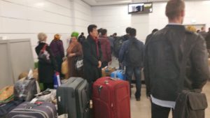
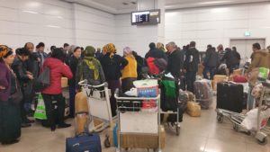
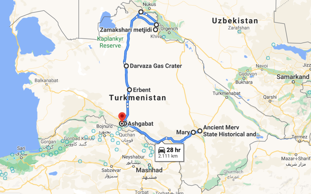

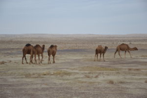


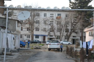
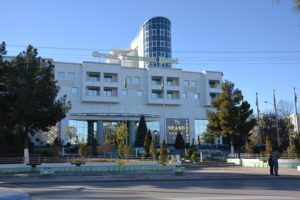

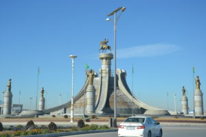

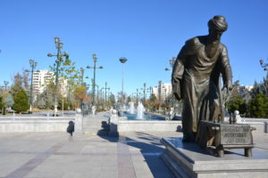

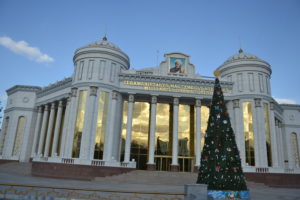
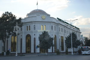

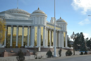
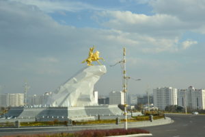
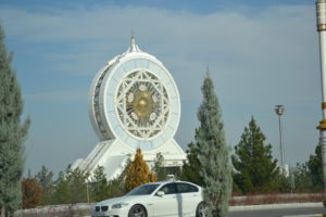
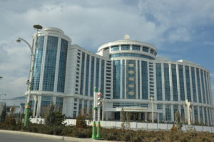

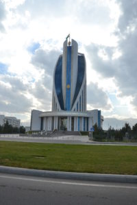
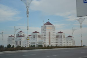
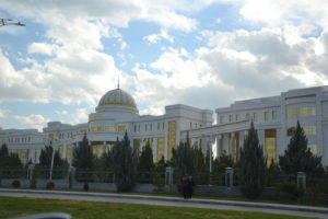
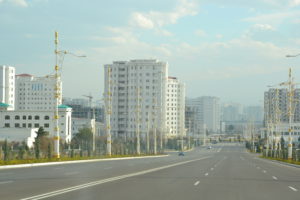
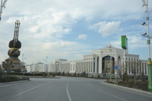
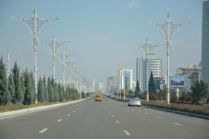
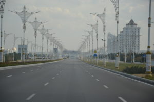
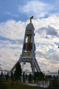
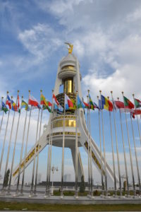
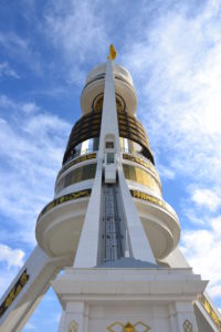
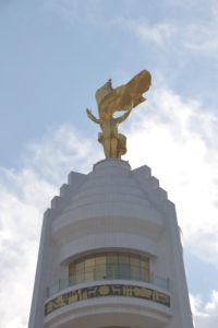
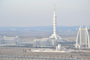
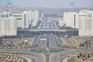
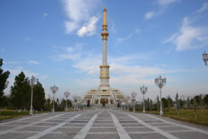
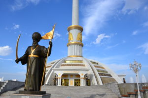
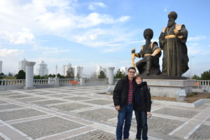
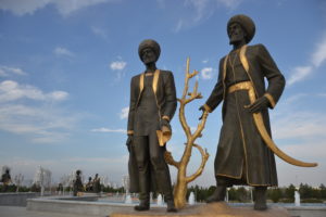
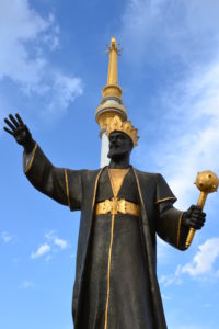
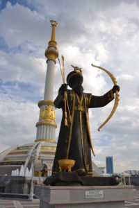
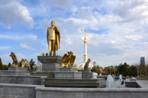
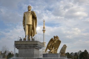
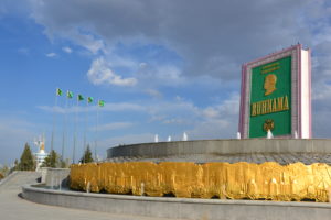
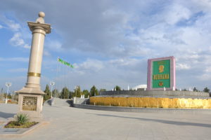
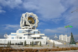

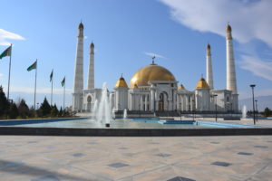
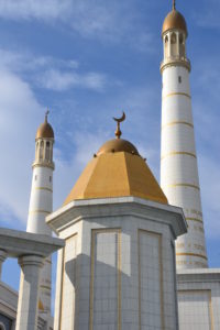


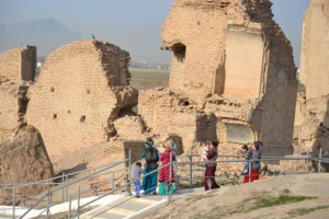
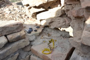
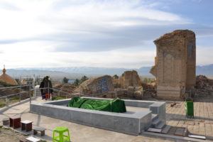
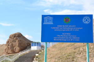
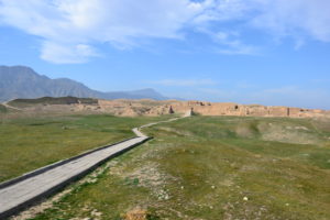
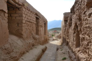
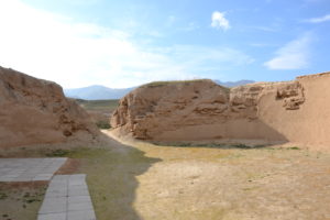
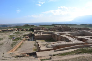
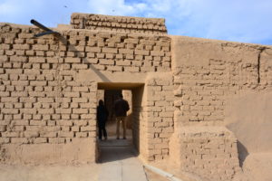
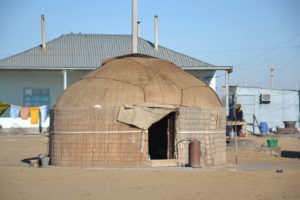

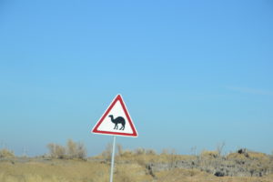
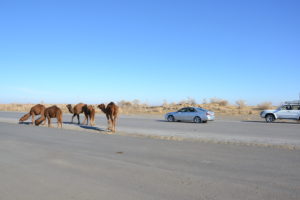
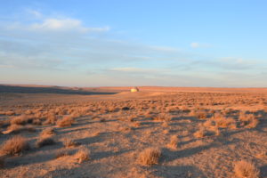
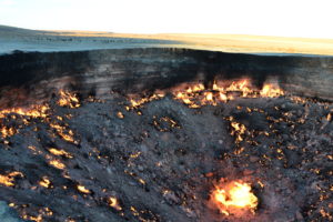
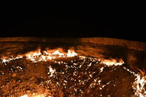
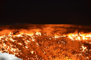
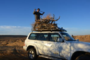


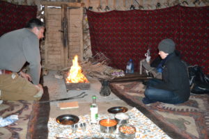
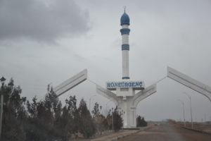
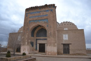

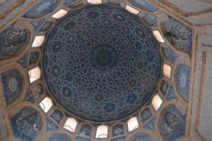
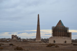
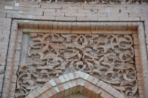

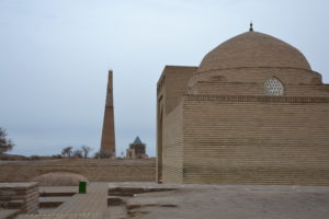
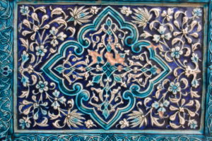
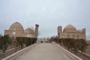
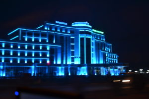
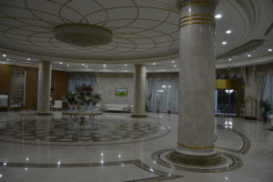

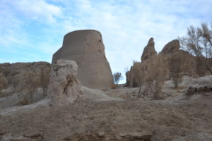
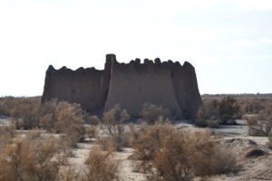
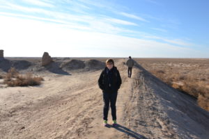


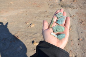
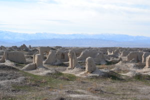
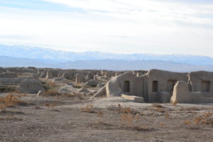
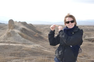
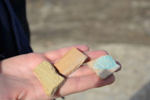

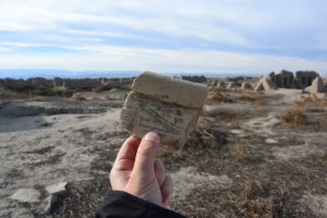

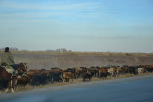

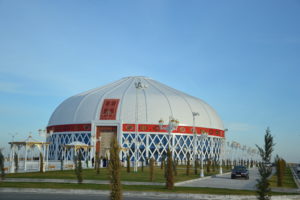
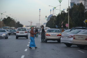

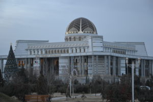
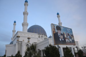
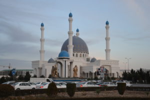


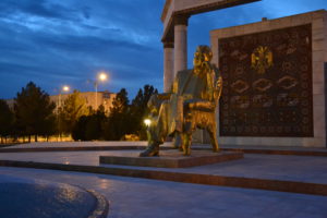

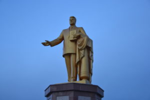
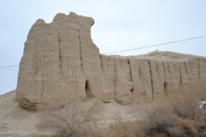
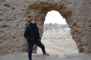
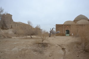

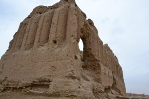

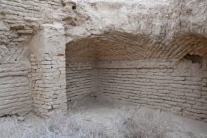
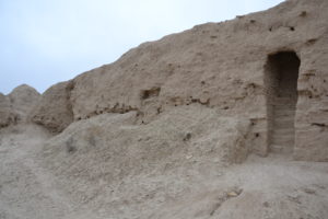
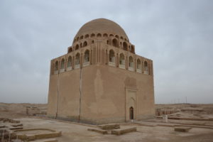
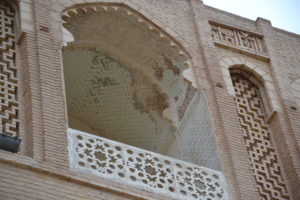
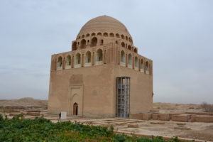


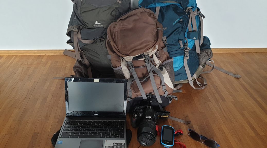
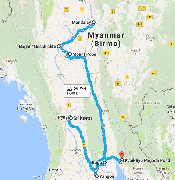
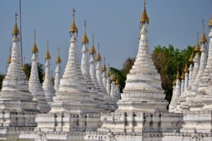
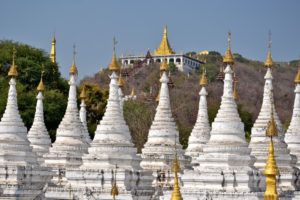
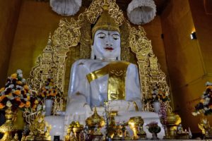
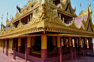
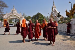
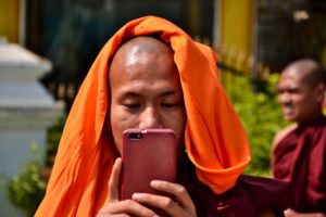

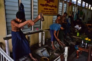
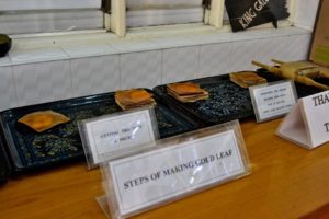
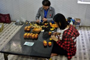
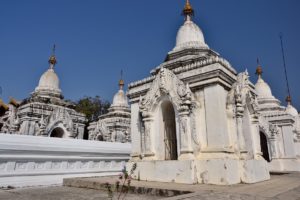
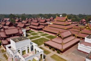
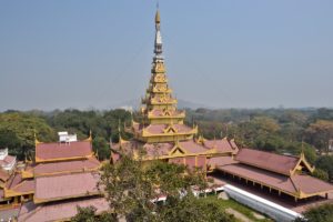
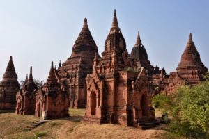
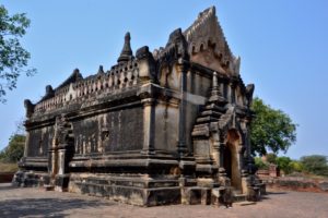
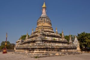
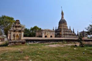
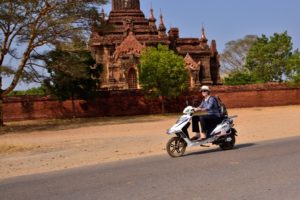
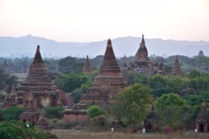
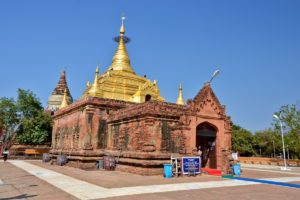
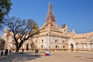
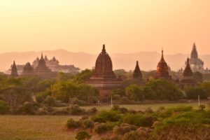
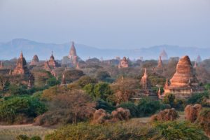
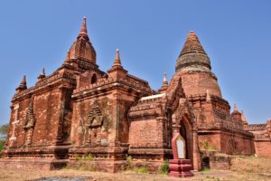
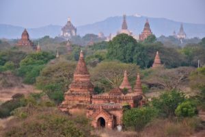
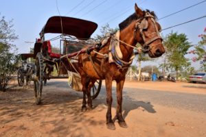
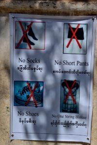
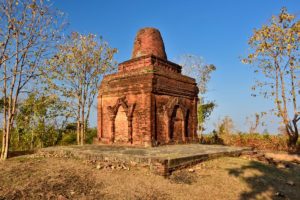
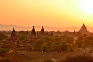
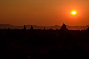

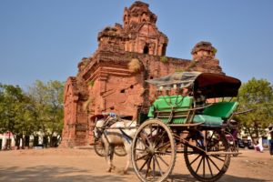
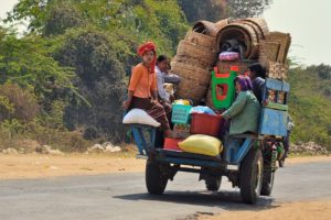
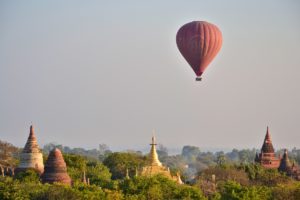
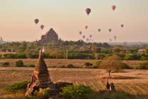
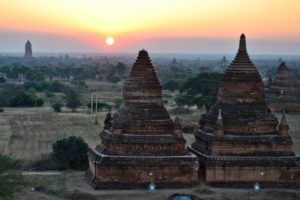

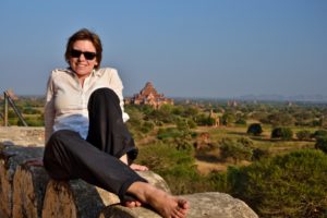
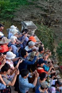
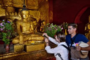
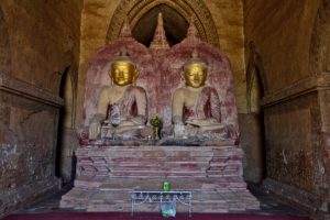
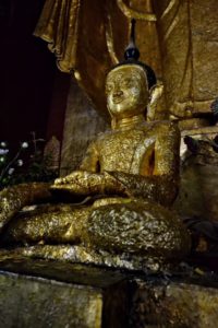
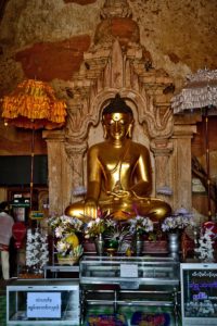
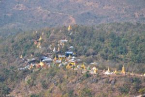
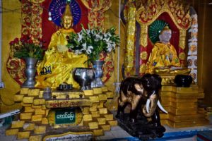
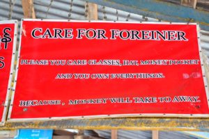
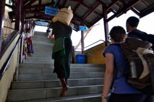
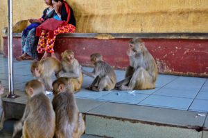
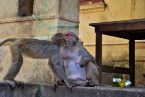
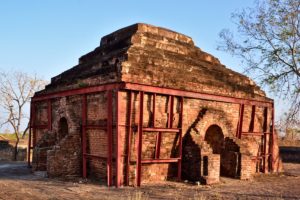
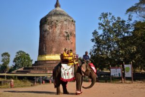
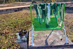
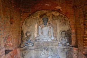
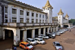
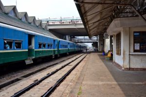
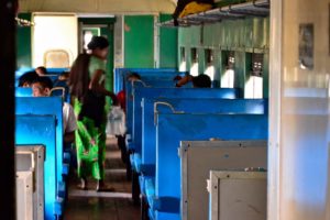
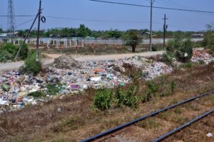
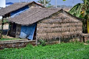


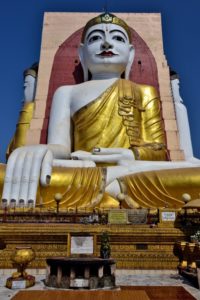
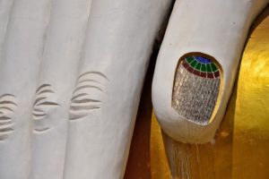

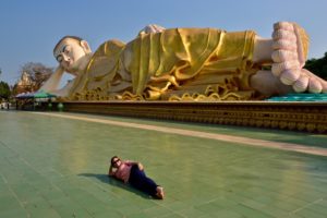
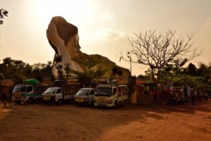
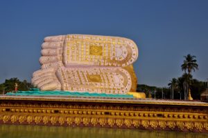
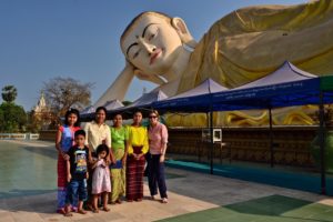
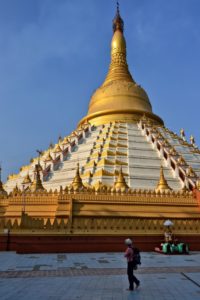
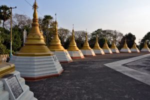
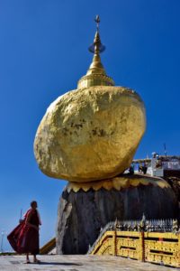
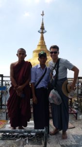
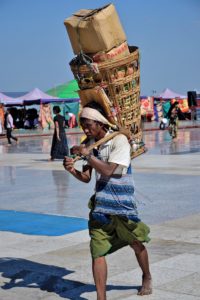
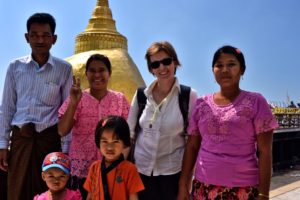
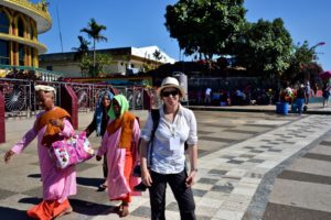
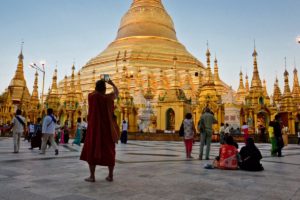
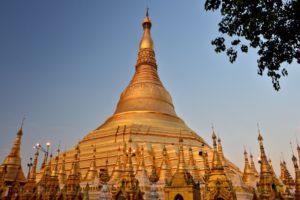
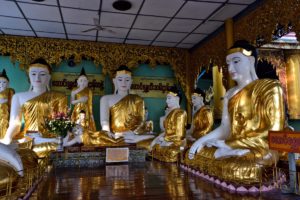
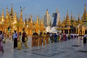
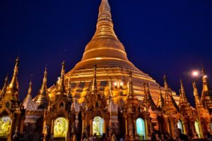
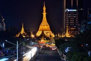
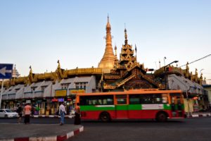
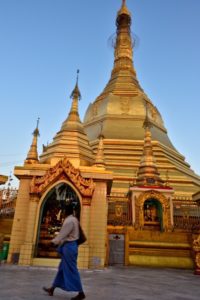
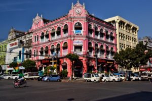
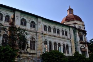
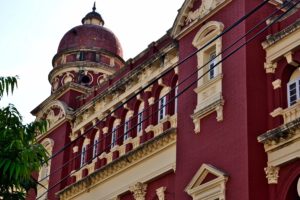


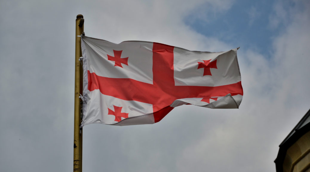
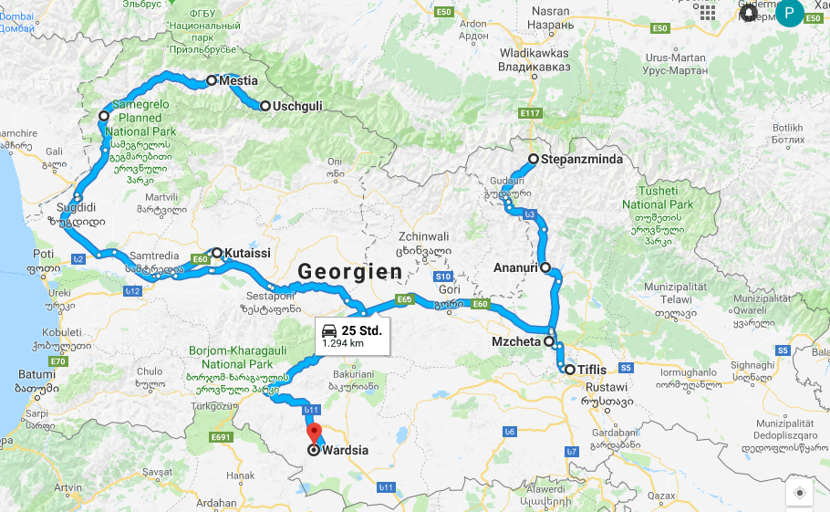


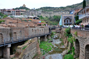
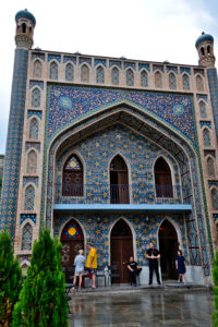
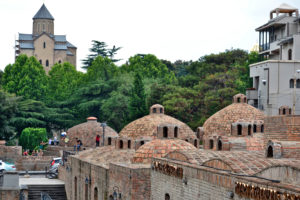
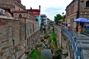
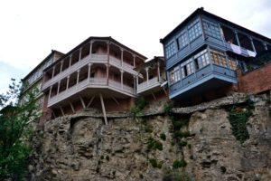

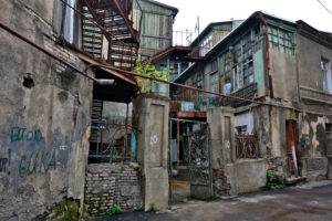
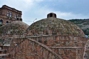

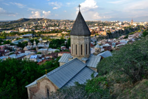
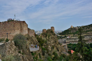
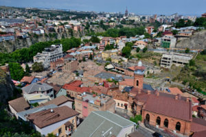
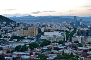

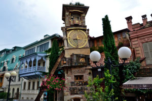
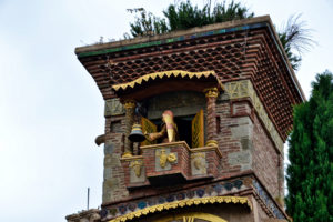
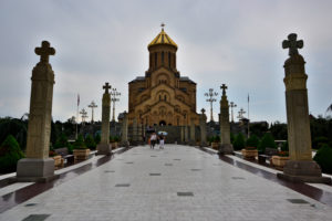
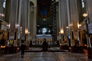
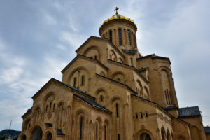
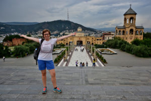


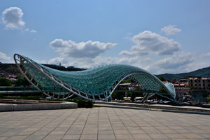

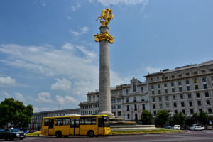
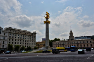
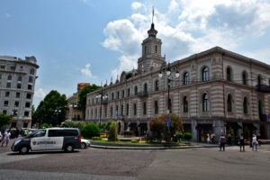

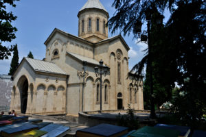
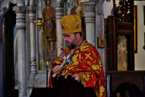

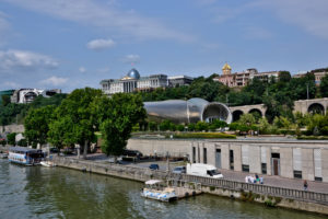

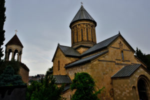
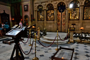
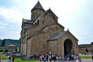
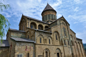
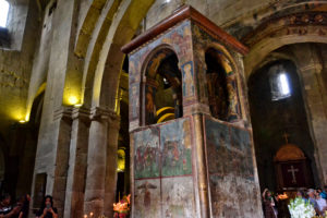
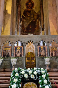
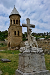


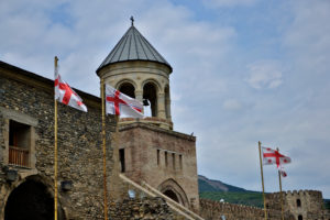

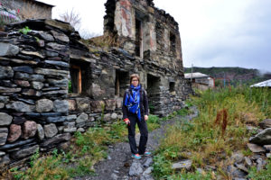
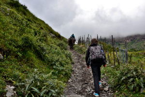
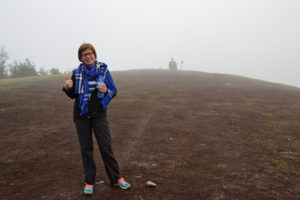
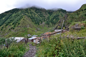

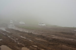
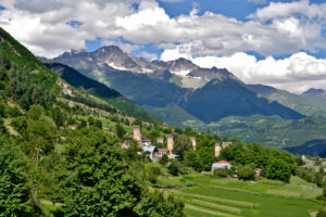


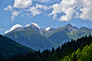
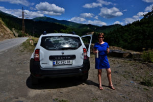
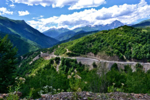

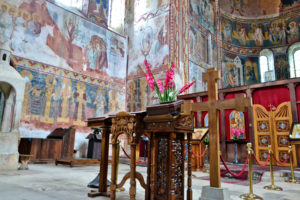
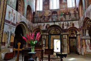
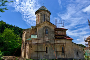
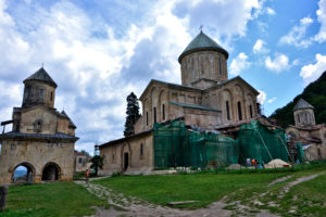
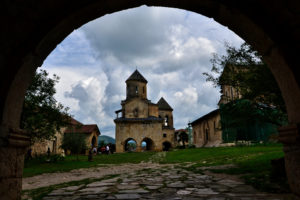
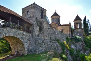
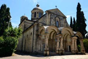


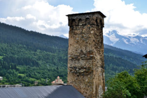
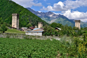
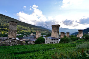

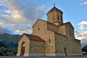
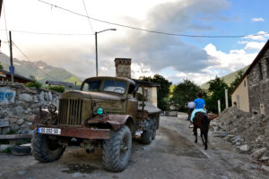

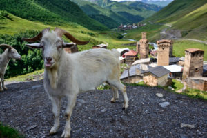
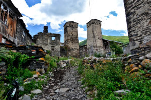

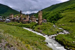

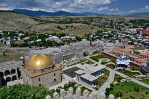


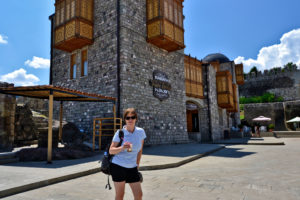
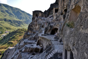

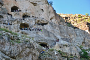
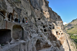
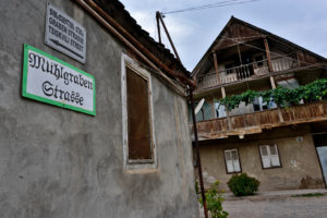
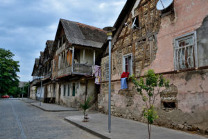
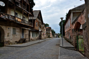

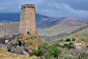
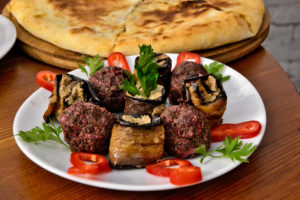
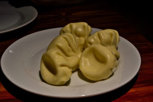

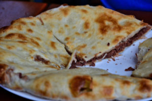


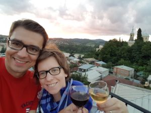

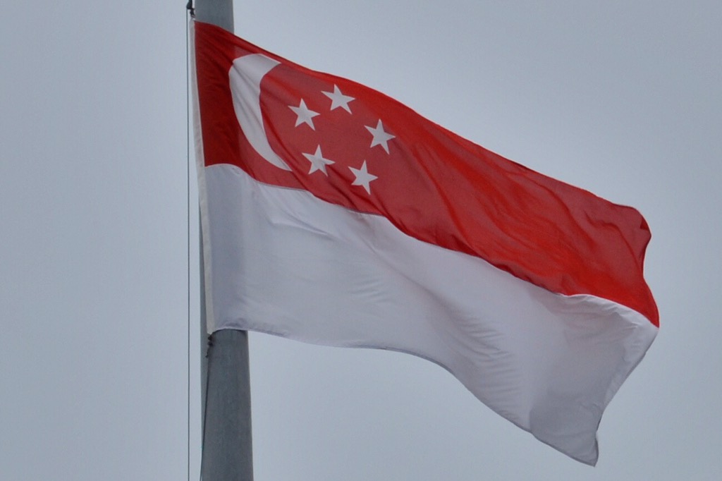
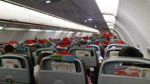
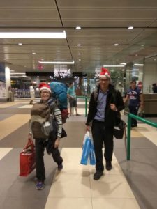
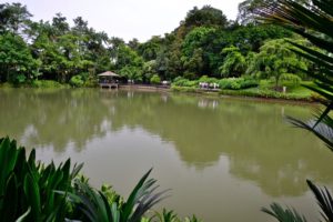
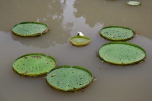
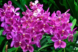
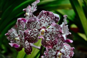
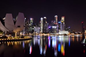
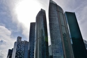
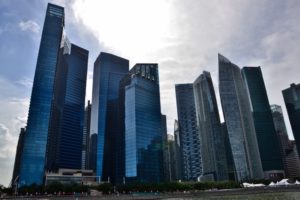
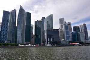
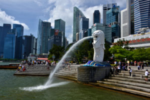
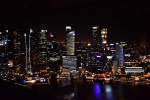
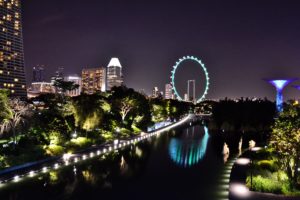
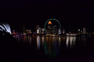
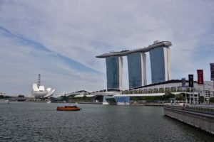
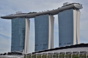
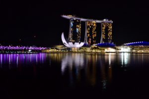
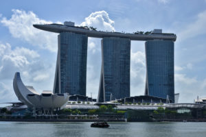
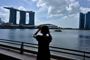
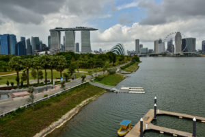
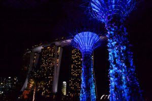
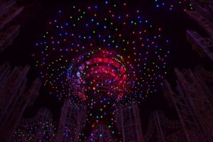
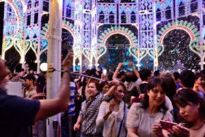
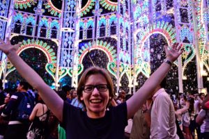
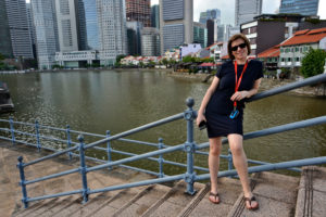
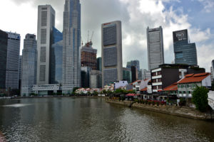
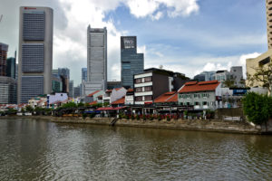
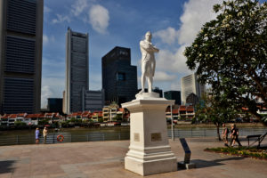
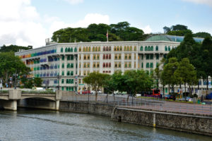
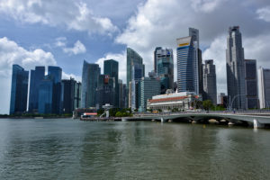

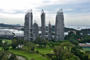
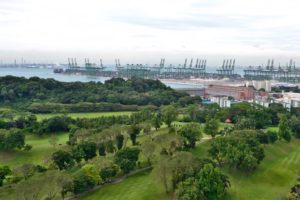
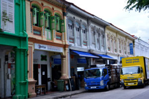
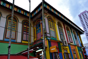
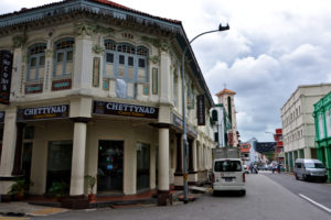

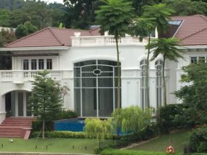
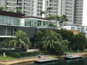


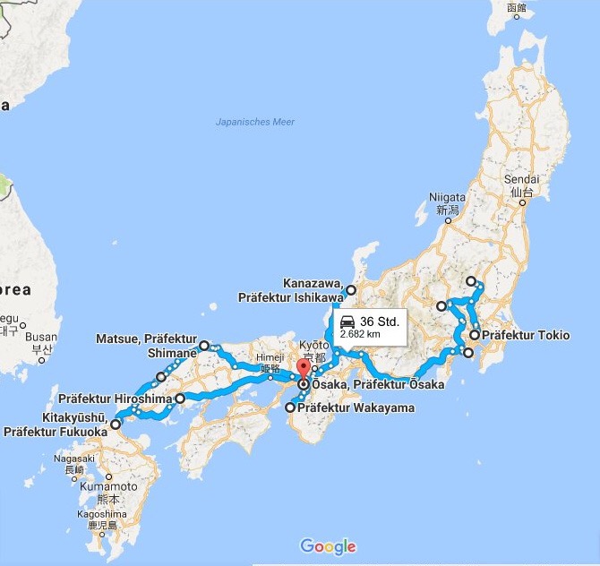

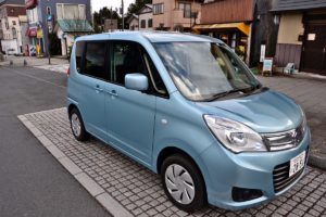

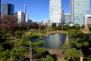
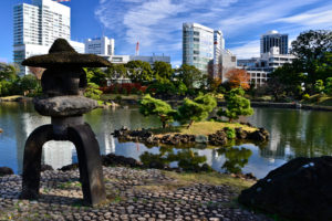


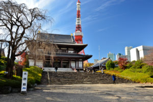
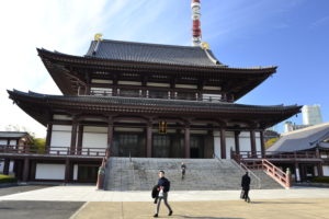
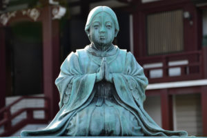
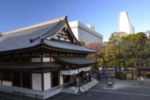


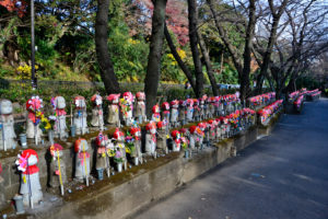
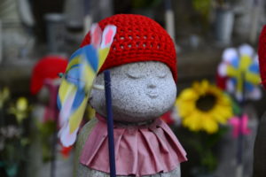


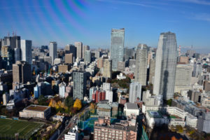
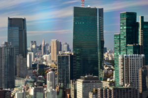


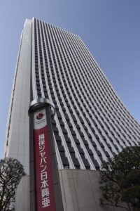


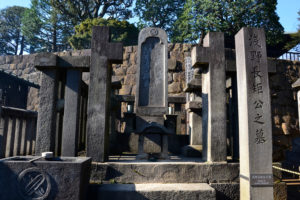
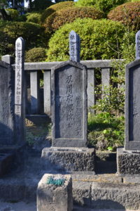
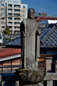
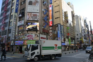
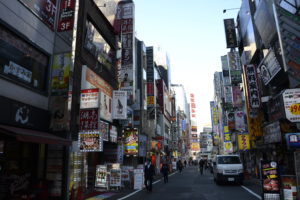
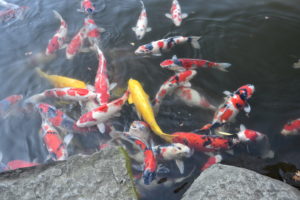
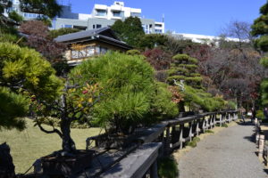

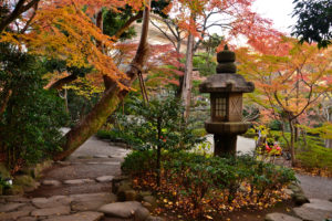
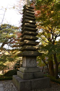
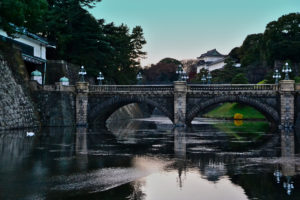

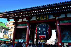
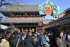
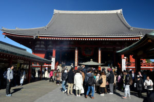
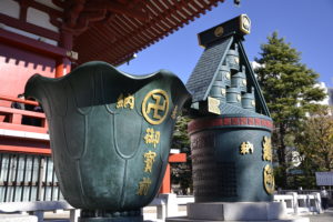
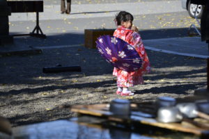
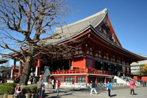
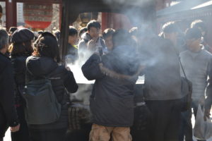
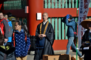
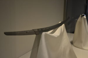
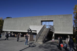
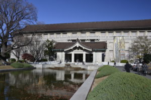

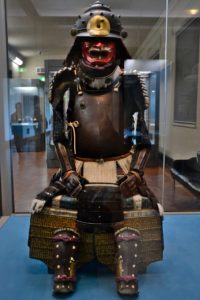
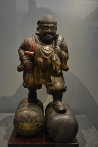
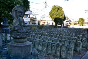

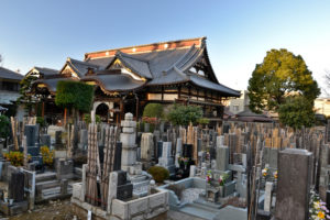


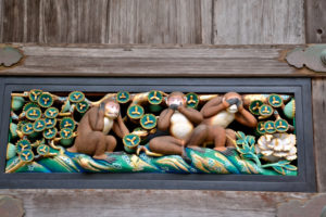
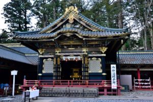

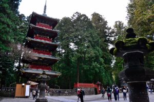
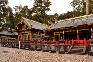
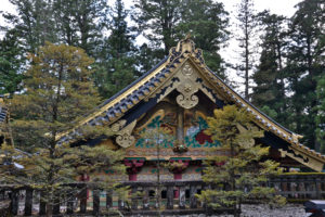
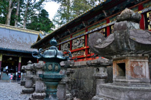
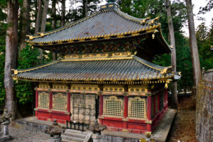
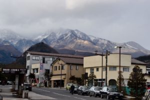
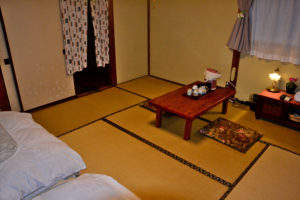


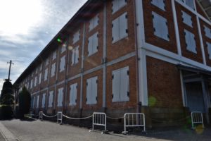
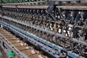
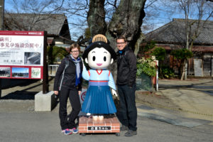
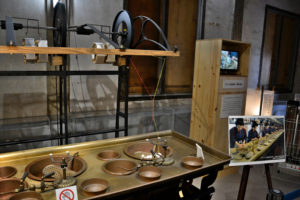
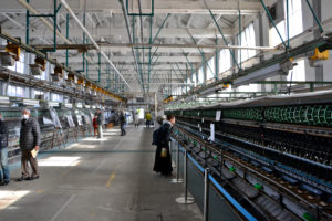
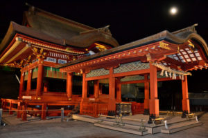

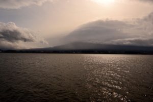
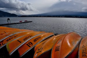

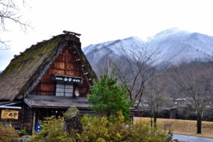
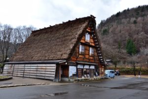
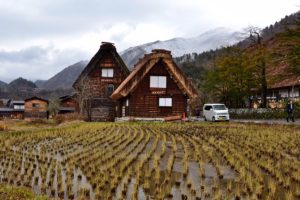

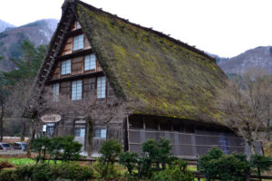
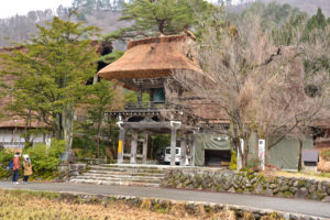
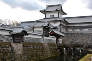
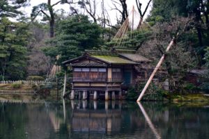
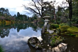
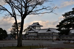
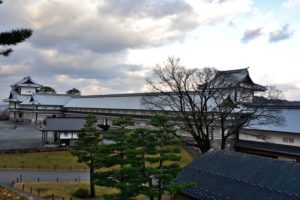
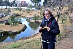

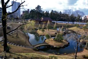


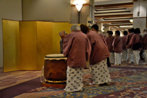
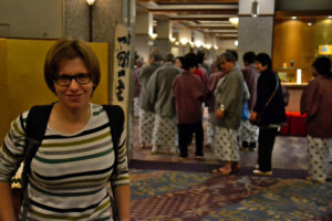
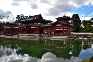
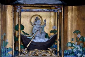
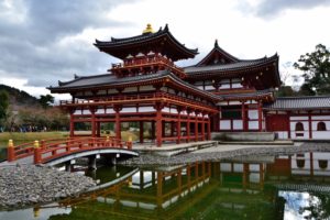
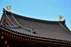
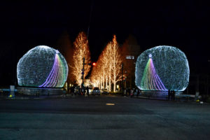
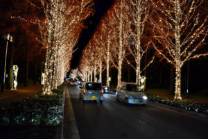
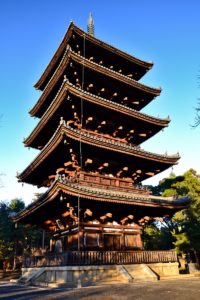
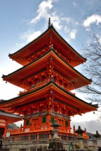
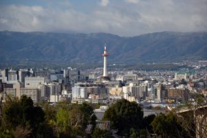
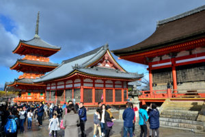
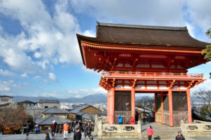

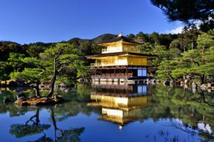
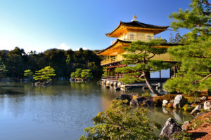
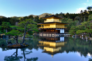
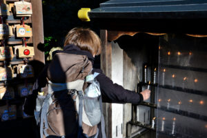
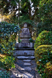
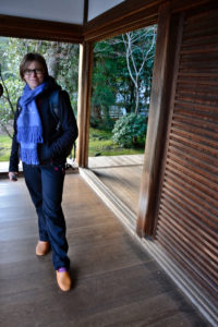
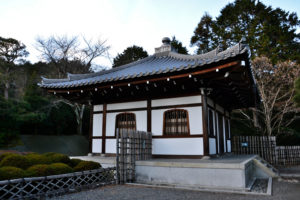
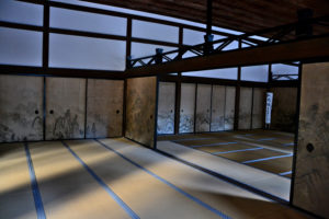
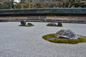
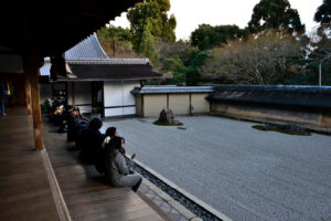
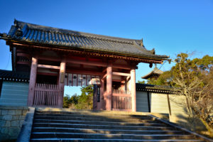
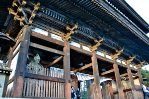
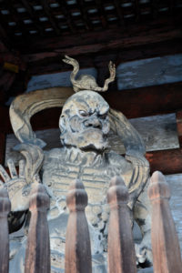
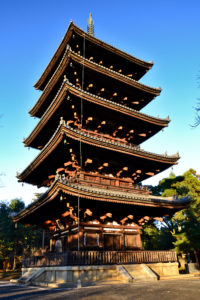


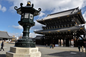
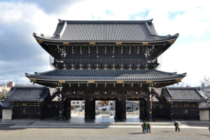
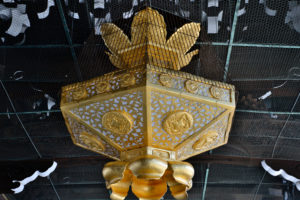
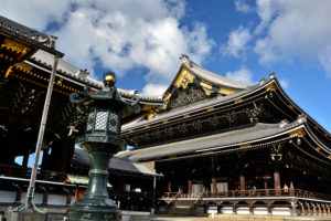

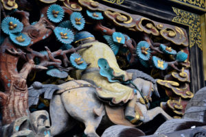
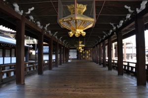
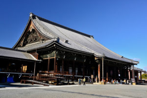
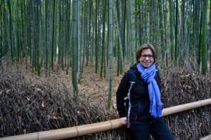
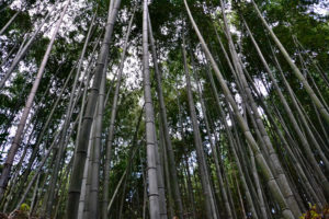
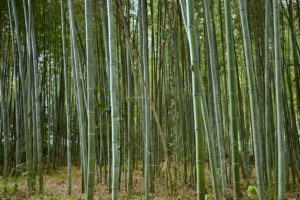

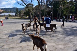

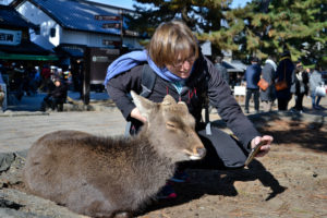


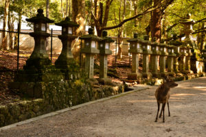
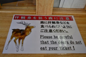

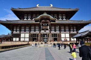
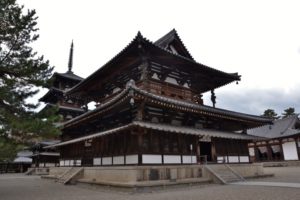
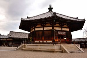


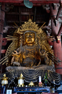
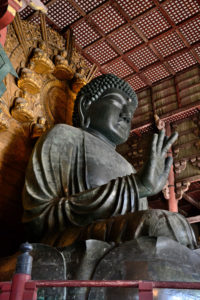
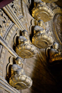


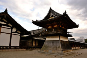
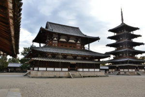
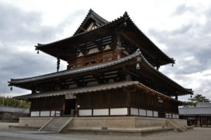
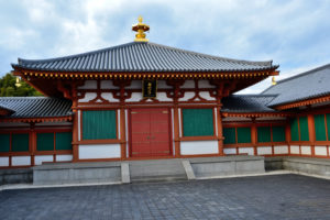
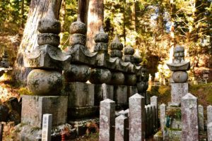
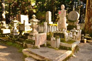
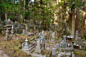

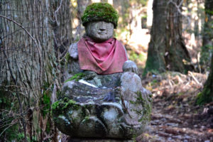
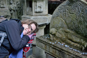
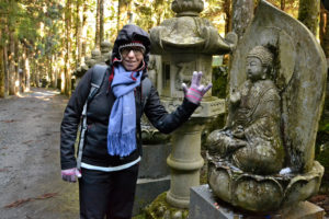
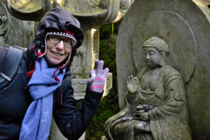

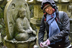

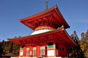
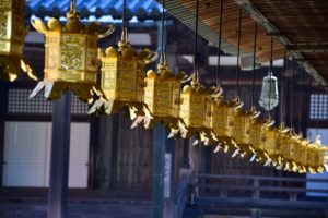
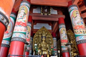

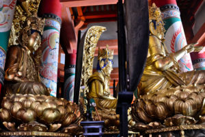
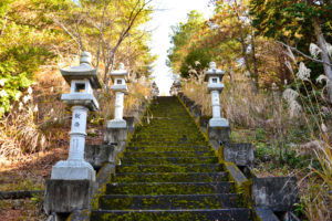

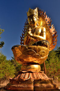
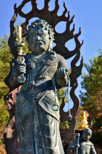
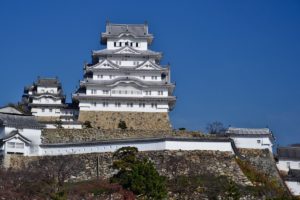
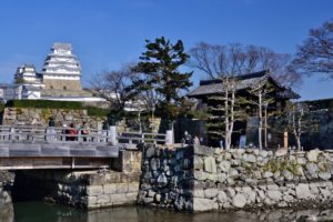
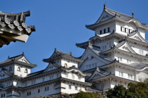
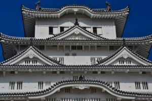


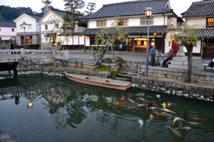
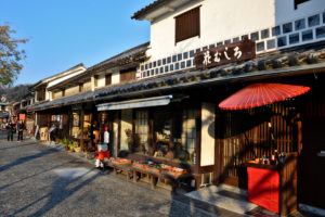
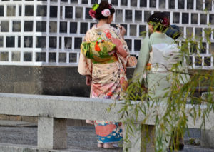
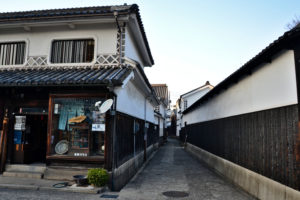
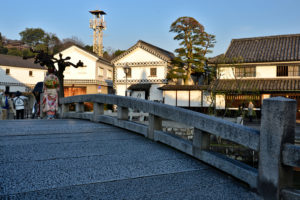
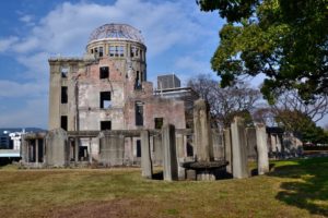
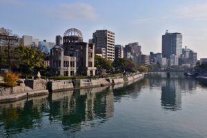

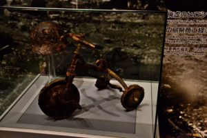

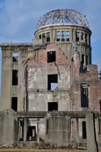
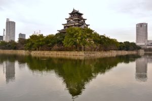
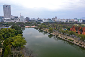

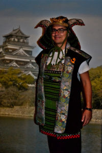

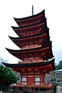

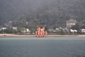
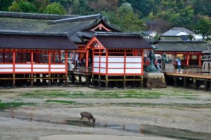
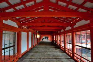
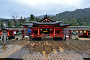
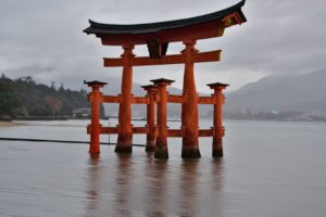
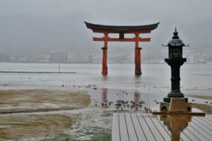
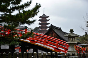
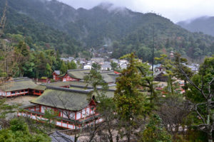
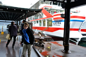
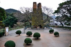
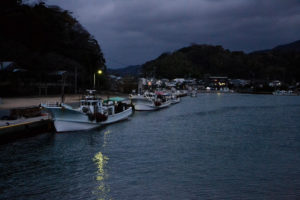
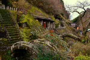
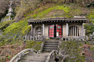

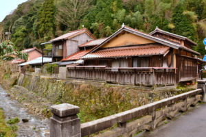


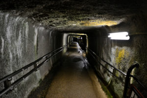
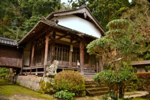
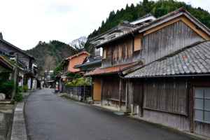
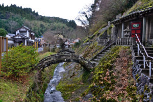

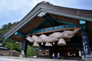
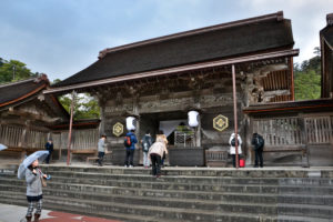

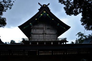
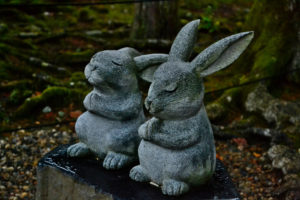
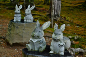
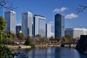
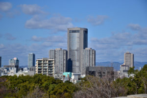

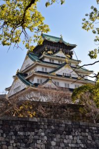
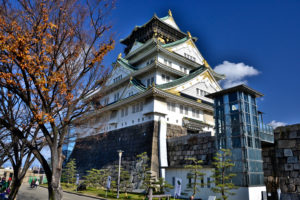
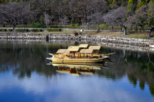

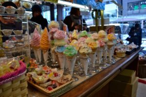
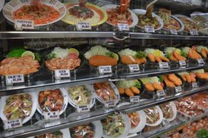
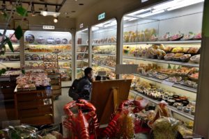

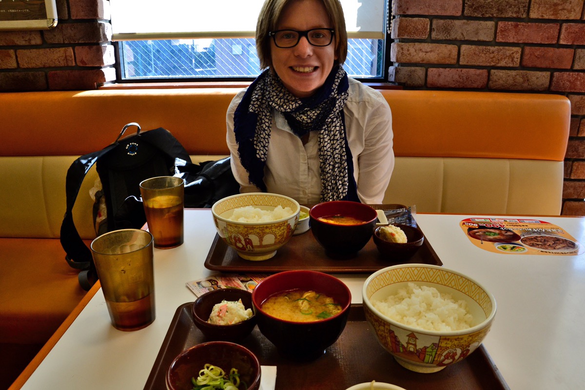

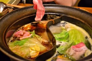

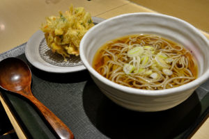
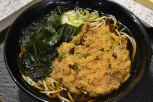
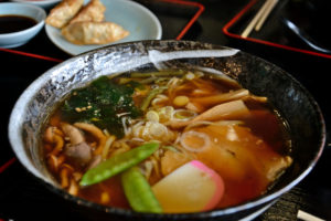


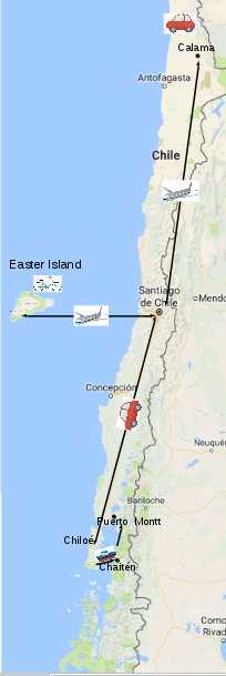


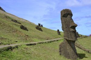


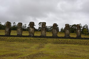


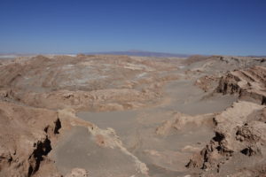
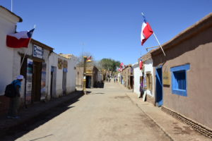
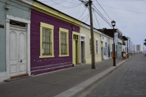

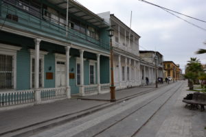

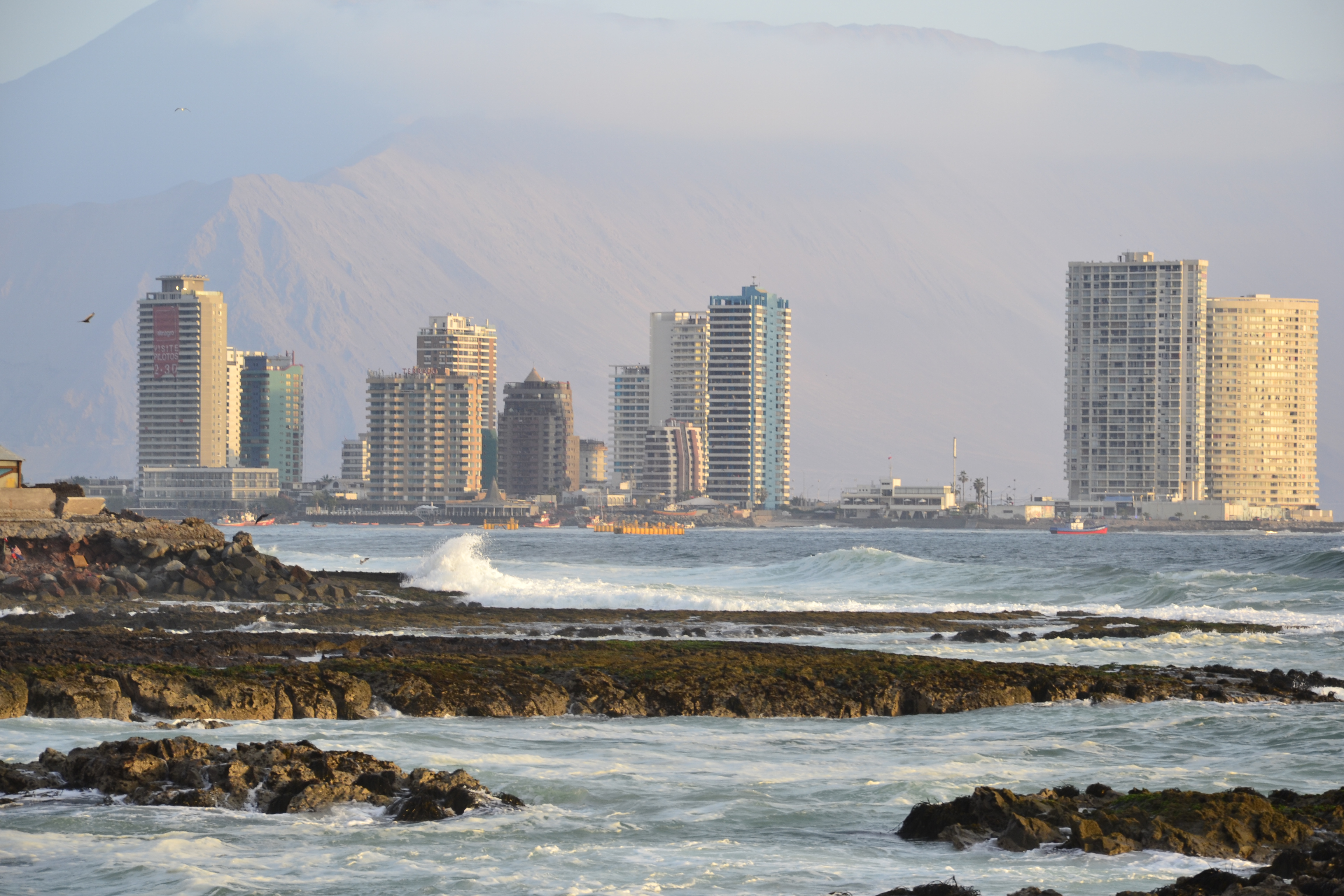
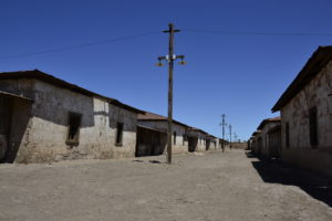
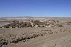


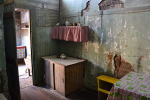
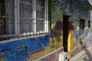

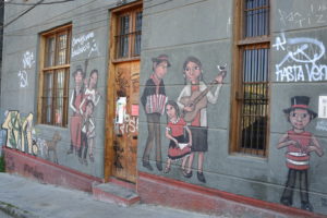
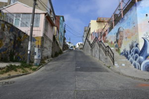
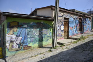
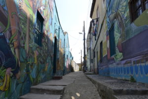
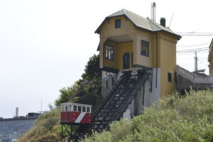
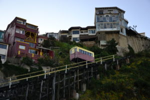
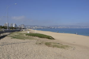

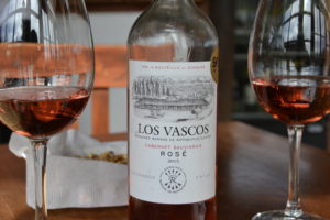


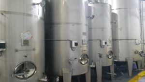
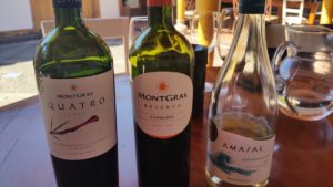
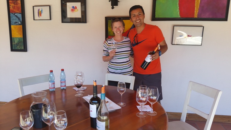


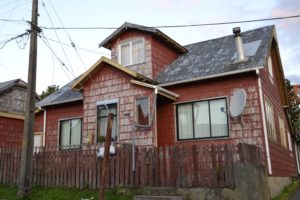
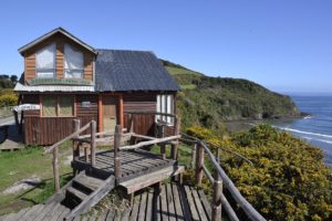


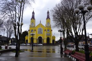
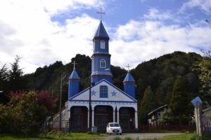
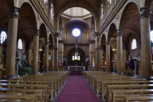
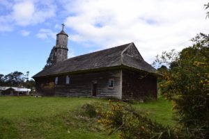
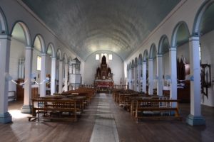
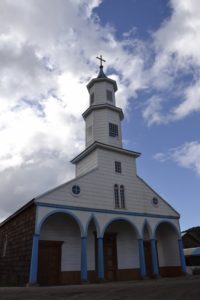
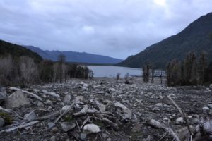
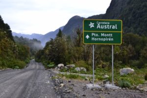

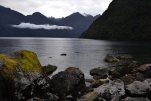
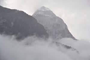
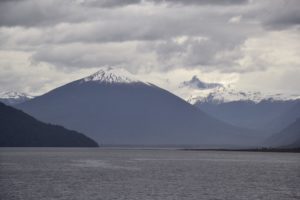


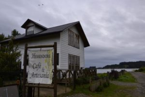


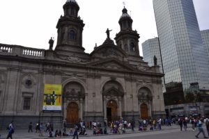

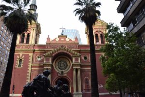
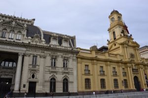
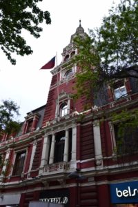
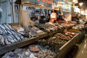


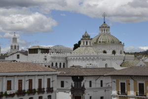

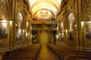
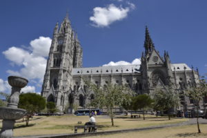

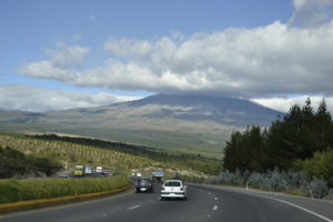

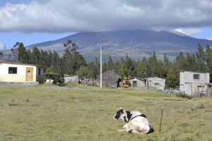


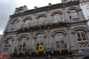

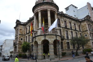

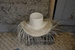


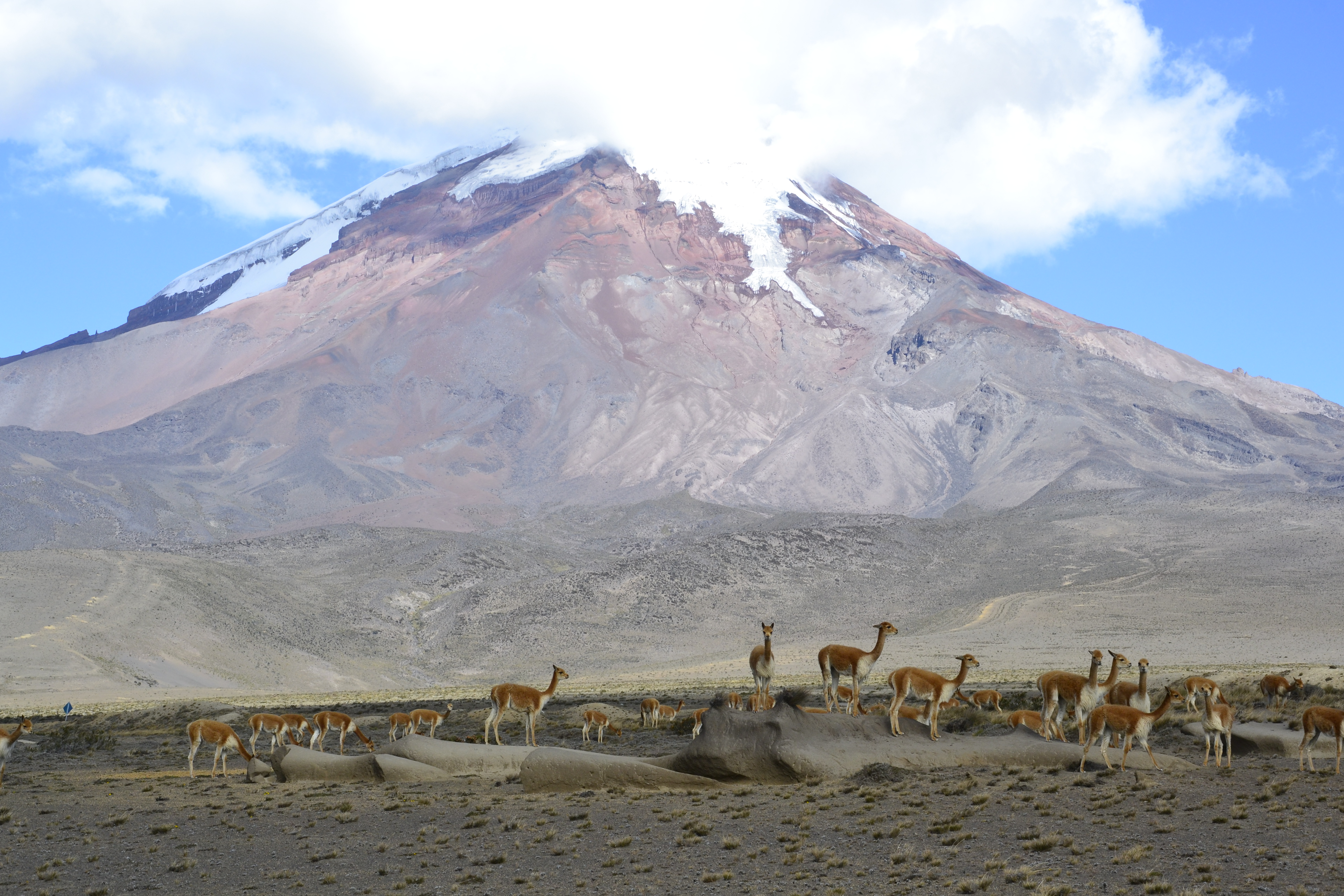
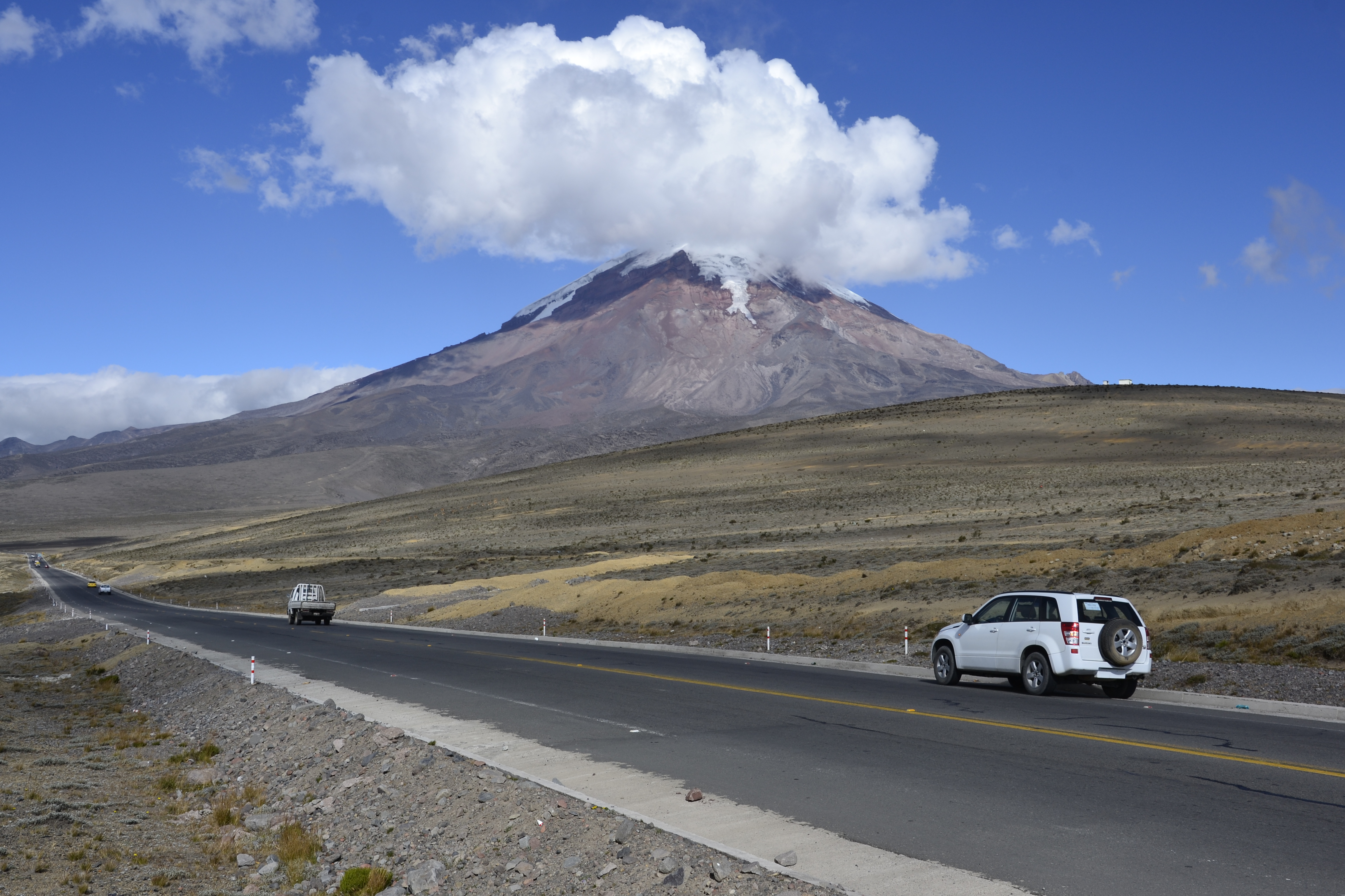
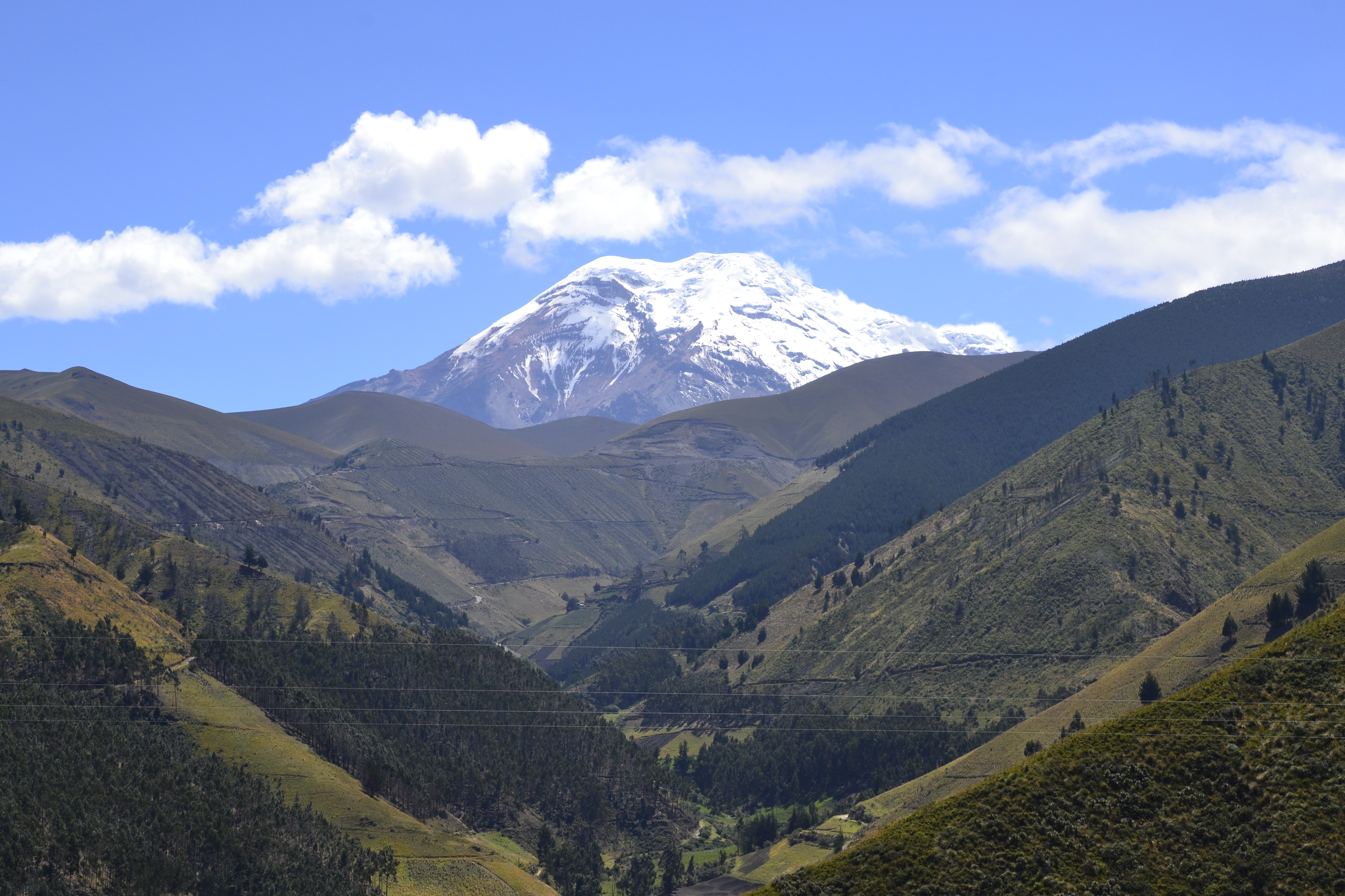

 In total, we drove around 4,850 km in New Zealand with our big vehicle. It’s not really a big issue due to the mainly empty roads. In addition, we have only seen one tourist driving on the wrong side of the road.